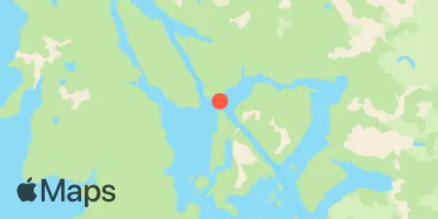
Olga Point Weekly Tide Tables and Charts
Tide Chart for Next 7 Days
About this chart
Olga Point weekly tide chart key:
The tide chart above shows the times and heights of high tide and low tide for Olga Point, for the next seven days. The red line highlights the current time and estimated height.The tidal range at Olga Point from through is approximately 11.4 ft, with a minimum tide of -0.48 ft and maximum tide of 10.92 ft. You can also check out all the daily details on tides & fishing times on the Day tab for Olga Point.
Tide Table for Next 7 Days
▲ Blue = High Tide
▼ Red = Low Tide
| Day | Moon phase | 1st Tide | 2nd Tide | 3rd Tide | 4th Tide | ☀ Sun |
Major Times

|
Minor Times

|
|---|---|---|---|---|---|---|---|---|
 50% |
▼ 0.08 ft |
▲ 8.22 ft |
▼ 4.87 ft |
▲ 9.07 ft |
▲ 7:14 AM ▼ 4:16 PM |
4:54 AM → 6:54 AM 5:28 PM → 7:28 PM |
1:49 PM → 2:49 PM 10:07 PM → 11:07 PM |
|
 48% |
▼ 0.71 ft |
▲ 8.43 ft |
▼ 4.47 ft |
▲ 8.4 ft |
▲ 7:16 AM ▼ 4:14 PM |
5:46 AM → 7:46 AM 6:19 PM → 8:19 PM |
1:58 PM → 2:58 PM | |
|
37%
|
▼ 1.12 ft |
▲ 8.93 ft |
▼ 3.48 ft |
▲ 8.2 ft |
▲ 7:19 AM ▼ 4:12 PM |
6:34 AM → 8:34 AM 7:06 PM → 9:06 PM |
11:40 PM → 12:40 AM 2:04 PM → 3:04 PM |
|
|
27%
|
▼ 1.41 ft |
▲ 9.53 ft |
▼ 2.26 ft |
▲ 8.34 ft |
▲ 7:21 AM ▼ 4:10 PM |
7:20 AM → 9:20 AM 7:52 PM → 9:52 PM |
1:09 AM → 2:09 AM 2:09 PM → 3:09 PM |
|
|
18%
|
▼ 1.69 ft |
▲ 10.11 ft |
▼ 1.1 ft |
▲ 8.61 ft |
▲ 7:23 AM ▼ 4:08 PM |
8:04 AM → 10:04 AM 8:36 PM → 10:36 PM |
2:35 AM → 3:35 AM 2:13 PM → 3:13 PM |
|
|
11%
|
▼ 2.04 ft |
▲ 10.59 ft |
▼ 0.17 ft |
▲ 8.88 ft |
▲ 7:25 AM ▼ 4:05 PM |
8:47 AM → 10:47 AM 9:20 PM → 11:20 PM |
3:59 AM → 4:59 AM 2:18 PM → 3:18 PM |
|
|
5%
|
▼ 2.45 ft |
▲ 10.92 ft |
▼ -0.48 ft |
▲ 7:28 AM ▼ 4:03 PM |
9:32 AM → 11:32 AM 10:06 PM → 12:06 AM |
5:23 AM → 6:23 AM 2:25 PM → 3:25 PM |
Location & Map
Nearby
Tides
1.9 mi
Whitestone Narrows, Neva Strait
10.0 mi
Scraggy Island
10.2 mi
Scraggy Point
10.4 mi
Haley Anchorage, Fish Bay
Currents
1.5 mi
Whitestone Narrows, S of Whitestone Point
2.0 mi
Creek Point, 0.44 n.mi. SE of
3.2 mi
Wyvill Reef
4.2 mi
Allan Pt., 1.5mile W of, Nakwasina Passage
4.3 mi
East Channel (narrows)
4.5 mi
Highwater Island, west of
4.8 mi
Zeal Point, 0.34 n.mi. SSW of
5.7 mi
West Channel (narrows)
11.4 mi
Kakul Narrows
12.0 mi
Suloia Point, 0.32 n.mi. ENE of
12.0 mi
Sinitsin Island
About these predictions
Tide heights are predictions, not measurements. Wind, air pressure, storms, and river flow can cause actual water levels to differ. Not for navigation.
Tide prediction source:
NOAA
Vertical datum:
MLLW — Mean Lower Low Water
Add a free tide or fishing times widget for this station to your website.