Auke Bay Tides & Fishing Times
Tides
Auke Bay tide chart key:
The tide chart above shows the times and heights of high tide and low tide for Auke Bay, as well as solunar period times (represented by fish icons). The red line highlights the current time and estimated height.| Day | Time | Tide | Height | |
|---|---|---|---|---|
| 1 Sat | ▼ Low | 1.65 ft | ||
| 2 Sun | ▲ High | 15.62 ft | ||
| 2 Sun | ▼ Low | -0.7 ft | ||
| 2 Sun | ▲ High | 15.64 ft | ||
| 2 Sun | ▼ Low | 1.46 ft | ||
| 3 Mon | ▲ High | 14.76 ft |
Sunday, August 2, 2026 7:44 AM: The tide is currently falling at Auke Bay with a current estimated height of 4.1 ft. The last tide was High at 3:44 AM and the next tide is a Low of -0.7 ft at 9:59 AM. The tidal range today is approximately 16.34 ft with a minimum tide of -0.7 ft and maximum tide of 15.64 ft.
Next 7 Days
▲ Blue = High Tide
▼ Red = Low Tide
| Day | 1st Tide | 2nd Tide | 3rd Tide | 4th Tide | ☀ Sun |
Major Solunars
|
Minor Solunars
|
|
|---|---|---|---|---|---|---|---|---|
| 2 Sun |
|
▲ 15.62 ft |
▼ -0.7 ft |
▲ 15.64 ft |
▼ 1.46 ft |
▲ 4:52 AM ▼ 9:16 PM |
2:53 AM → 4:53 AM 3:04 PM → 5:04 PM |
9:43 AM → 10:43 AM 9:25 PM → 10:25 PM |
| 3 Mon |
|
▲ 14.76 ft |
▼ 0.34 ft |
▲ 15.69 ft |
▼ 1.46 ft |
▲ 4:54 AM ▼ 9:14 PM |
3:36 AM → 5:36 AM 3:49 PM → 5:49 PM |
11:10 AM → 12:10 PM 9:28 PM → 10:28 PM |
| 4 Tue |
|
▲ 13.64 ft |
▼ 1.7 ft |
▲ 15.58 ft |
▲ 4:57 AM ▼ 9:11 PM |
4:22 AM → 6:22 AM 4:36 PM → 6:36 PM |
12:40 PM → 1:40 PM 9:32 PM → 10:32 PM |
|
| 5 Wed |
|
▼ 1.65 ft |
▲ 12.37 ft |
▼ 3.27 ft |
▲ 15.29 ft |
▲ 4:59 AM ▼ 9:09 PM |
5:12 AM → 7:12 AM 5:26 PM → 7:26 PM |
2:14 PM → 3:14 PM 9:39 PM → 10:39 PM |
| 6 Thu |
|
▼ 1.89 ft |
▲ 11.19 ft |
▼ 4.82 ft |
▲ 14.94 ft |
▲ 5:01 AM ▼ 9:06 PM |
6:06 AM → 8:06 AM 6:30 PM → 8:30 PM |
3:52 PM → 4:52 PM 9:53 PM → 10:53 PM |
| 7 Fri |
|
▼ 1.9 ft |
▲ 10.63 ft |
▼ 5.97 ft |
▲ 14.86 ft |
▲ 5:03 AM ▼ 9:04 PM |
7:04 AM → 9:04 AM 7:34 PM → 9:34 PM |
5:47 PM → 6:47 PM 10:22 PM → 11:22 PM |
| 8 Sat |
|
▼ 1.3 ft |
▲ 11.19 ft |
▼ 6.11 ft |
▲ 15.33 ft |
▲ 5:05 AM ▼ 9:01 PM |
8:07 AM → 10:07 AM 8:43 PM → 10:43 PM |
7:04 PM → 8:04 PM 11:22 PM → 12:22 AM |
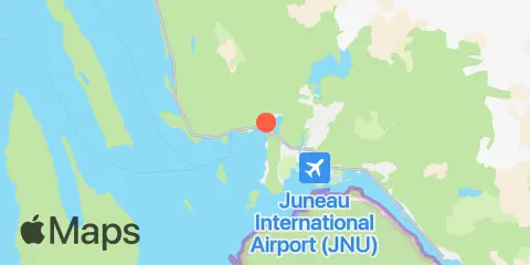
Location & Map
Nearby
Tides
4.8 mi
Fritz Cove, Douglas Island
9.4 mi
Barlow Cove, Mansfield Peninsula, Lynn Canal
10.2 mi
Juneau, Gastineau Channel, Stephens Pass
Currents
4.9 mi
Portland Island, SW of
6.2 mi
Piling Point, east of
8.8 mi
Saginaw Channel, 2 miles E of Point Retreat
9.1 mi
Aurora Basin, SW of
9.9 mi
Juneau Harbor, N of
9.9 mi
West Juneau, NE of
10.7 mi
Juneau Harbor, S of
11.2 mi
Juneau Harbor, S of
11.4 mi
Douglas, north of
11.9 mi
Point Retreat, 1 mile west of
12.2 mi
North Pass, Lincoln Island
12.3 mi
Point Young
Note: Tide predictions are an estimate and NOT FOR NAVIGATION.
We also offer free widgets if you want to add tide or solunar tables to your own site.