Applegate Island Tides & Fishing Times
Tides
Applegate Island tide chart key:
The tide chart above shows the times and heights of high tide and low tide for Applegate Island, as well as solunar period times (represented by fish icons). The red line highlights the current time and estimated height.| Day | Time | Tide | Height | |
|---|---|---|---|---|
| 1 Sat | ▼ Low | 1.72 ft | ||
| 2 Sun | ▲ High | 11.43 ft | ||
| 2 Sun | ▼ Low | -0.53 ft | ||
| 2 Sun | ▲ High | 11.41 ft | ||
| 2 Sun | ▼ Low | 1.48 ft | ||
| 3 Mon | ▲ High | 10.67 ft |
Sunday, August 2, 2026 7:46 AM: The tide is currently falling at Applegate Island with a current estimated height of 4.1 ft. The last tide was High at 4:00 AM and the next tide is a Low of -0.53 ft at 10:32 AM. The tidal range today is approximately 11.96 ft with a minimum tide of -0.53 ft and maximum tide of 11.43 ft.
Next 7 Days
▲ Blue = High Tide
▼ Red = Low Tide
| Day | 1st Tide | 2nd Tide | 3rd Tide | 4th Tide | ☀ Sun |
Major Solunars
|
Minor Solunars
|
|
|---|---|---|---|---|---|---|---|---|
| 2 Sun |
|
▲ 11.43 ft |
▼ -0.53 ft |
▲ 11.41 ft |
▼ 1.48 ft |
▲ 5:32 AM ▼ 10:24 PM |
3:48 AM → 5:48 AM 3:58 PM → 5:58 PM |
10:41 AM → 11:41 AM 10:16 PM → 11:16 PM |
| 3 Mon |
|
▲ 10.67 ft |
▼ 0.35 ft |
▲ 11.56 ft |
▼ 1.36 ft |
▲ 5:35 AM ▼ 10:21 PM |
4:32 AM → 6:32 AM 4:43 PM → 6:43 PM |
12:12 PM → 1:12 PM 10:15 PM → 11:15 PM |
| 4 Tue |
|
▲ 9.7 ft |
▼ 1.45 ft |
▲ 11.6 ft |
▲ 5:37 AM ▼ 10:18 PM |
5:18 AM → 7:18 AM 5:30 PM → 7:30 PM |
1:47 PM → 2:47 PM 10:14 PM → 11:14 PM |
|
| 5 Wed |
|
▼ 1.38 ft |
▲ 8.62 ft |
▼ 2.68 ft |
▲ 11.53 ft |
▲ 5:40 AM ▼ 10:16 PM |
6:08 AM → 8:08 AM 6:28 PM → 8:28 PM |
3:26 PM → 4:26 PM 10:15 PM → 11:15 PM |
| 6 Thu |
|
▼ 1.46 ft |
▲ 7.76 ft |
▼ 3.89 ft |
▲ 11.45 ft |
▲ 5:42 AM ▼ 10:13 PM |
7:02 AM → 9:02 AM 7:26 PM → 9:26 PM |
5:33 PM → 6:33 PM 10:20 PM → 11:20 PM |
| 7 Fri |
|
▼ 1.42 ft |
▲ 7.55 ft |
▼ 4.87 ft |
▲ 11.56 ft |
▲ 5:45 AM ▼ 10:10 PM |
8:01 AM → 10:01 AM 8:30 PM → 10:30 PM |
7:24 PM → 8:24 PM 10:37 PM → 11:37 PM |
| 8 Sat |
|
▼ 0.96 ft |
▲ 8.01 ft |
▼ 5.23 ft |
▲ 11.97 ft |
▲ 5:47 AM ▼ 10:07 PM |
9:04 AM → 11:04 AM 9:40 PM → 11:40 PM |
8:45 PM → 9:45 PM |
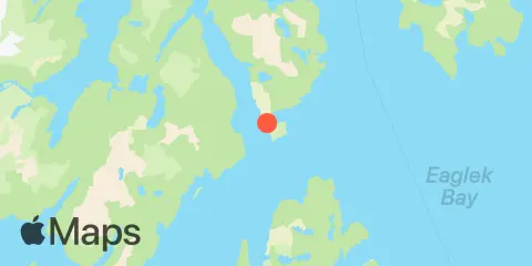
Location & Map
Latitude
60° 37' 24" N (60.6233)
Longitude
148° 9' 54" W (-148.165)
State
County
Nearby
Tides
5.8 mi
Long Bay Entrance, Culross Passage, Prince William Sound
8.2 mi
Culross Bay, Wells Passage, Prince William Sound
8.6 mi
South Bay, Perry Island
11.5 mi
Kings Bay, Port Nellie Juan, Prince William Sound
11.9 mi
Eshamy Lagoon, Prince William Sound
Currents
6.0 mi
Perry Passage
9.2 mi
Point Culross
12.3 mi
Crafton Island - Knight Island Pass
Note: Tide predictions are an estimate and NOT FOR NAVIGATION.
We also offer free widgets if you want to add tide or solunar tables to your own site.