Village Point Weekly Tide Tables and Charts
Tide Chart for Next 7 Days
Village Point weekly tide chart key:
The tide chart above shows the times and heights of high tide and low tide for Village Point, for the next seven days. The red line highlights the current time and estimated height.The tidal range at Village Point for the next seven days is approximately 10.62 ft with a minimum tide of -1.44 ft and maximum tide of 9.18 ft. You can also check out all the daily details on tides & fishing times on the Day tab for Village Point.
Tide Table for Next 7 Days
▲ Blue = High Tide
▼ Red = Low Tide
| Day | 1st Tide | 2nd Tide | 3rd Tide | 4th Tide | ☀ Sun |
Major Solunars
|
Minor Solunars
|
|
|---|---|---|---|---|---|---|---|---|
| 30 Thu |
|
▼ 6.36 ft |
▲ 6.86 ft |
▼ -1.44 ft |
▲ 9.18 ft |
▲ 5:42 AM ▼ 8:51 PM |
12:53 AM → 2:53 AM 1:07 PM → 3:07 PM |
6:13 AM → 7:13 AM 9:02 PM → 10:02 PM |
| 31 Fri |
|
▼ 5.81 ft |
▲ 6.53 ft |
▼ -0.93 ft |
▲ 9.12 ft |
▲ 5:44 AM ▼ 8:50 PM |
1:38 AM → 3:38 AM 1:51 PM → 3:51 PM |
7:26 AM → 8:26 AM 9:17 PM → 10:17 PM |
| 1 Sat |
|
▼ 5.13 ft |
▲ 6.18 ft |
▼ -0.15 ft |
▲ 9 ft |
▲ 5:45 AM ▼ 8:48 PM |
2:21 AM → 4:21 AM 2:34 PM → 4:34 PM |
8:38 AM → 9:38 AM 9:31 PM → 10:31 PM |
| 2 Sun |
|
▼ 4.33 ft |
▲ 5.86 ft |
▼ 0.89 ft |
▲ 8.86 ft |
▲ 5:46 AM ▼ 8:47 PM |
3:04 AM → 5:04 AM 3:18 PM → 5:18 PM |
9:50 AM → 10:50 AM 9:46 PM → 10:46 PM |
| 3 Mon |
|
▼ 3.4 ft |
▲ 5.59 ft |
▼ 2.15 ft |
▲ 8.75 ft |
▲ 5:48 AM ▼ 8:45 PM |
3:47 AM → 5:47 AM 4:02 PM → 6:02 PM |
11:04 AM → 12:04 PM 10:01 PM → 11:01 PM |
| 4 Tue |
|
▼ 2.38 ft |
▲ 5.49 ft |
▼ 3.53 ft |
▲ 8.7 ft |
▲ 5:49 AM ▼ 8:44 PM |
4:33 AM → 6:33 AM 4:50 PM → 6:50 PM |
12:20 PM → 1:20 PM 10:20 PM → 11:20 PM |
| 5 Wed |
|
▼ 1.31 ft |
▲ 5.74 ft |
▼ 4.94 ft |
▲ 8.7 ft |
▲ 5:50 AM ▼ 8:42 PM |
5:22 AM → 7:22 AM 5:42 PM → 7:42 PM |
1:40 PM → 2:40 PM 10:44 PM → 11:44 PM |
Buoy Weather
Wind
14 knots WSW (240°)
Wind Gust
18 knots
Atmospheric Pressure
1018 hPa
Note: Observations are from a weather buoy 6.04 miles from the prediction site. Observations are not available at all prediction sites, and observation types vary between sites.
More details: Station 46118 Buoy Weather
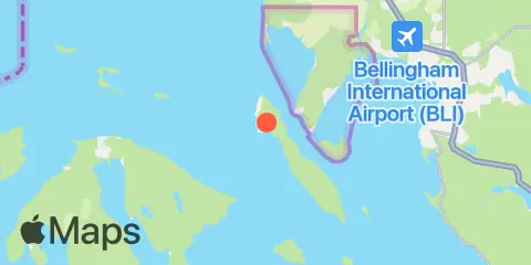
Location & Map
Latitude
48° 43' 0" N (48.7167)
Longitude
122° 42' 29" W (-122.708)
State
County
Nearest ZIP
98262
Nearby
Tides
2.0 mi
Gooseberry Point, Hale Passage
2.3 mi
Point Migley, Hale Passage
5.1 mi
Sandy Point, Lummi Bay
8.1 mi
Ferndale, Strait of Georgia
8.8 mi
Rosario, East Sound, Orcas Island
9.1 mi
Echo Bay, Sucia Islands, Strait of Georgia
9.1 mi
Peavine Pass
9.2 mi
Tide Point, Cypress Island
9.9 mi
Bellingham, Bellingham Bay
10.4 mi
Cherry Point, Strait of Georgia
10.5 mi
Strawberry Bay, Cypress Island
Currents
1.8 mi
Hale Passage, east of Lummi Point
2.6 mi
Lawrence Point, Orcas Island, 1.3 nm NE of
3.1 mi
Clark Island, 1.6 nm north of
4.3 mi
Barnes Island, 0.8 mile southwest of
5.5 mi
Sinclair Island, 1.0 nm NE of
5.6 mi
Raccoon Point, 0.6 mile NNE of
6.8 mi
Peapod Rocks Light, 1.2 nm south of
7.2 mi
Towhead Island, 0.4 mile east of
7.3 mi
Matia Island, west of
7.5 mi
Matia Island, 0.8 mile west of
8.1 mi
Cherry Point, 1.8 nm southeast of
8.2 mi
Parker Reef Light, north of
8.6 mi
Puffin Island Light, 4.8 miles north of
8.9 mi
Bellingham Channel North Entrance
9.2 mi
Obstruction Pass, north of Obstruction Island
10.3 mi
Peavine Pass, west entrance
10.4 mi
Cherry Point
11.0 mi
Strawberry Island, west of
11.0 mi
Patos Island, south of Toe Point
11.1 mi
Bellingham Channel, off Cypress Head Light
12.3 mi
Bellingham Channel South
Note: Tide predictions are an estimate and NOT FOR NAVIGATION.
We also offer free widgets if you want to add tide or solunar tables to your own site.