Naselle River Weekly Tide Tables and Charts
Tide Chart for Next 7 Days
Naselle River weekly tide chart key:
The tide chart above shows the times and heights of high tide and low tide for Naselle River, for the next seven days. The red line highlights the current time and estimated height.The tidal range at Naselle River for the next seven days is approximately 10.84 ft with a minimum tide of -0.65 ft and maximum tide of 10.19 ft. You can also check out all the daily details on tides & fishing times on the Day tab for Naselle River.
Tide Table for Next 7 Days
▲ Blue = High Tide
▼ Red = Low Tide
| Day | 1st Tide | 2nd Tide | 3rd Tide | 4th Tide | ☀ Sun |
Major Solunars
|
Minor Solunars
|
|
|---|---|---|---|---|---|---|---|---|
| 21 Tue |
|
▼ 1.12 ft |
▲ 7.07 ft |
▼ 1.89 ft |
▲ 9.82 ft |
▲ 5:44 AM ▼ 8:59 PM |
6:09 AM → 8:09 AM 6:26 PM → 8:26 PM |
2:01 PM → 3:01 PM |
| 22 Wed |
|
▼ 0.96 ft |
▲ 6.46 ft |
▼ 2.69 ft |
▲ 9.61 ft |
▲ 5:45 AM ▼ 8:58 PM |
6:54 AM → 8:54 AM 7:12 PM → 9:12 PM |
11:39 PM → 12:39 AM 3:09 PM → 4:09 PM |
| 23 Thu |
|
▼ 0.7 ft |
▲ 6.34 ft |
▼ 3.27 ft |
▲ 9.49 ft |
▲ 5:46 AM ▼ 8:57 PM |
7:40 AM → 9:40 AM 8:00 PM → 10:00 PM |
12:04 AM → 1:04 AM 4:16 PM → 5:16 PM |
| 24 Fri |
|
▼ 0.37 ft |
▲ 6.61 ft |
▼ 3.55 ft |
▲ 9.51 ft |
▲ 5:48 AM ▼ 8:56 PM |
8:27 AM → 10:27 AM 8:50 PM → 10:50 PM |
12:35 AM → 1:35 AM 5:19 PM → 6:19 PM |
| 25 Sat |
|
▼ 0.01 ft |
▲ 7.03 ft |
▼ 3.56 ft |
▲ 9.68 ft |
▲ 5:49 AM ▼ 8:54 PM |
9:17 AM → 11:17 AM 9:41 PM → 11:41 PM |
1:14 AM → 2:14 AM 6:21 PM → 7:21 PM |
| 26 Sun |
|
▼ -0.34 ft |
▲ 7.45 ft |
▼ 3.4 ft |
▲ 5:50 AM ▼ 8:53 PM |
10:05 AM → 12:05 PM 10:33 PM → 12:33 AM |
2:03 AM → 3:03 AM 7:08 PM → 8:08 PM |
|
| 27 Mon |
|
▲ 9.93 ft |
▼ -0.65 ft |
▲ 7.83 ft |
▼ 3.16 ft |
▲ 5:51 AM ▼ 8:52 PM |
10:53 AM → 12:53 PM |
3:01 AM → 4:01 AM 7:46 PM → 8:46 PM |
Buoy Weather
Air Temperature
66° F
Wind
14 knots NW (310°)
Wind Gust
16 knots
Note: Observations are from a weather buoy 13 miles from the prediction site. Observations are not available at all prediction sites, and observation types vary between sites.
More details: Station asto3 Buoy Weather
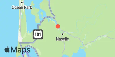
Location & Map
Latitude
46° 23' 18" N (46.3883)
Longitude
123° 50' 24" W (-123.84)
State
County
Nearest ZIP
98638
Nearby
Tides
4.2 mi
Naselle River, swing bridge, Willapa Bay
5.4 mi
Greenhead Slough
7.5 mi
Paradise Point, Long Island, Willapa Bay
8.0 mi
Tarlatt Slough, Willapa Bay
9.0 mi
Hungry Harbor
9.6 mi
Chinook, Baker Bay
11.2 mi
Ilwaco, Baker Bay
11.7 mi
Nahcotta, Willapa Bay
12.3 mi
Cape Disappointment
12.4 mi
Harrington Point
Currents
10.1 mi
Point Ellice, east of
10.9 mi
McGowan, SSW of
11.0 mi
Sand Island, SSE of
11.5 mi
Baker Bay entrance, E of Sand Island Tower
11.7 mi
Sand Island Tower, 0.9nm SE of (north channel)
11.7 mi
Chinook Point, WSW of
11.8 mi
Sand Island Tower, 1nm SE of (midchannel)
12.2 mi
Tongue Point, northwest of
12.3 mi
Clatsop Spit, NNE of
Note: Tide predictions are an estimate and NOT FOR NAVIGATION.
We also offer free widgets if you want to add tide or solunar tables to your own site.