Dungeness Weekly Tide Tables and Charts
Tide Chart for Next 7 Days
Dungeness weekly tide chart key:
The tide chart above shows the times and heights of high tide and low tide for Dungeness, for the next seven days. The red line highlights the current time and estimated height.The tidal range at Dungeness for the next seven days is approximately 8.71 ft with a minimum tide of -0.94 ft and maximum tide of 7.77 ft. You can also check out all the daily details on tides & fishing times on the Day tab for Dungeness.
Tide Table for Next 7 Days
▲ Blue = High Tide
▼ Red = Low Tide
| Day | 1st Tide | 2nd Tide | 3rd Tide | 4th Tide | ☀ Sun |
Major Solunars
|
Minor Solunars
|
|
|---|---|---|---|---|---|---|---|---|
| 30 Thu |
|
▲ 6.65 ft |
▼ -0.94 ft |
▲ 7.68 ft |
▼ 5.13 ft |
▲ 5:46 AM ▼ 8:51 PM |
12:55 AM → 2:55 AM 1:09 PM → 3:09 PM |
6:17 AM → 7:17 AM 9:02 PM → 10:02 PM |
| 31 Fri |
|
▲ 6.47 ft |
▼ -0.62 ft |
▲ 7.73 ft |
▲ 5:47 AM ▼ 8:50 PM |
1:39 AM → 3:39 AM 1:53 PM → 3:53 PM |
7:28 AM → 8:28 AM 9:18 PM → 10:18 PM |
|
| 1 Sat |
|
▼ 4.52 ft |
▲ 6.18 ft |
▼ -0.07 ft |
▲ 7.76 ft |
▲ 5:48 AM ▼ 8:48 PM |
2:22 AM → 4:22 AM 2:36 PM → 4:36 PM |
8:40 AM → 9:40 AM 9:33 PM → 10:33 PM |
| 2 Sun |
|
▼ 3.75 ft |
▲ 5.81 ft |
▼ 0.74 ft |
▲ 7.77 ft |
▲ 5:50 AM ▼ 8:47 PM |
3:05 AM → 5:05 AM 3:20 PM → 5:20 PM |
9:52 AM → 10:52 AM 9:48 PM → 10:48 PM |
| 3 Mon |
|
▼ 2.84 ft |
▲ 5.43 ft |
▼ 1.77 ft |
▲ 7.74 ft |
▲ 5:51 AM ▼ 8:45 PM |
3:49 AM → 5:49 AM 4:04 PM → 6:04 PM |
11:05 AM → 12:05 PM 10:04 PM → 11:04 PM |
| 4 Tue |
|
▼ 1.86 ft |
▲ 5.13 ft |
▼ 2.94 ft |
▲ 7.68 ft |
▲ 5:52 AM ▼ 8:44 PM |
4:35 AM → 6:35 AM 4:52 PM → 6:52 PM |
12:21 PM → 1:21 PM 10:23 PM → 11:23 PM |
| 5 Wed |
|
▼ 0.89 ft |
▲ 5.06 ft |
▼ 4.14 ft |
▲ 7.62 ft |
▲ 5:54 AM ▼ 8:42 PM |
5:24 AM → 7:24 AM 5:43 PM → 7:43 PM |
1:40 PM → 2:40 PM 10:47 PM → 11:47 PM |
Buoy Weather
Air Temperature
53° F
Water Temperature
52° F
Wind
14 knots WSW (250°)
Wind Gust
16 knots
Waves
1.6 ft
WSW (250°)
Average Wave Period
3.2 sec
Dominant Wave Period
4 sec
Atmospheric Pressure
1018 hPa
Note: Observations are from a weather buoy 11.78 miles from the prediction site. Observations are not available at all prediction sites, and observation types vary between sites.
More details: Station 46088 Buoy Weather
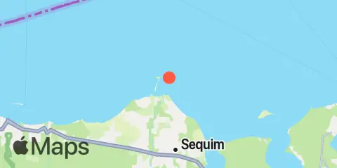
Location & Map
Latitude
48° 10' 0" N (48.1667)
Longitude
123° 7' 1" W (-123.117)
State
County
Nearest ZIP
98382
Nearby
Tides
6.8 mi
Sequim Bay entrance, Strait of Juan de Fuca
11.9 mi
Gardiner, Discovery Bay, Strait of Juan de Fuca
Currents
4.7 mi
New Dungeness Light, 2.8 mi. NNW of
6.9 mi
Violet Point, 3.7 mi. NW of Protection Island
7.6 mi
New Dungeness Light, 6 miles NNE of
7.7 mi
Ediz Hook Light, 5.3 mi. ENE of
7.8 mi
Kanem Point, 1.5 mi. SW of Protection Island
9.5 mi
Discovery Island, 7.6 mi. SSE of
Note: Tide predictions are an estimate and NOT FOR NAVIGATION.
We also offer free widgets if you want to add tide or solunar tables to your own site.