New Point (Comfort Shoal) Tides
Unfortunately, this tide station is no longer active, and predictions are no longer accurate.
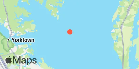
You can check out the map below -- any nearby locations will be displayed on the map and list below. Alternatively, you can browse the site for other active locations.
Location & Map
Latitude
37° 15' 24" N (37.2567)
Longitude
76° 13' 18" W (-76.2217)
State
County
Nearest ZIP
23138
Nearby
Tides
9.1 mi
Tue Marshes Light, York River
9.4 mi
Wolf Trap Light, Chesapeake Bay
9.6 mi
Old Plantation Light, Chesapeake Bay
10.3 mi
Browns Bay, Mobjack Bay
10.6 mi
Mobjack, East River, Mobjack Bay
11.1 mi
Cape Charles Harbor (USCG Wharf), Chesapeake Bay
11.6 mi
Messick Point, Back River, Chesapeake Bay
12.0 mi
Goodwin Neck, Yorktown, York River
Currents
2.9 mi
New Point Comfort, 4.1 n.mi. ESE of
4.6 mi
York Spit Light, 0.8 mile southwest of
5.2 mi
York River Ent. Channel (NW end)
5.3 mi
York Spit Channel, N of Buoy '26'
6.1 mi
New Point Comfort, 2.0 n.mi. WSW of
7.1 mi
Cape Charles City, 3.3 n.mi. west of
8.6 mi
Old Plantation Flats Lt., 0.5 mi. W of
9.2 mi
Tue Marshes Light, 0.7 n.mi. north of
9.3 mi
Wolf Trap Light, 0.5 mile west of
9.4 mi
York River Entrance Channel (SE end)
10.0 mi
Tue Marshes Light, 0.9 n.mi. WNW of
11.0 mi
Wolf Trap Light, 1.4 n.mi. NNE of
11.1 mi
Wolf Trap Light, 2.0 n.mi. NW of
12.1 mi
Wolf Trap Light, 5.8 miles east of
12.3 mi
North edge of channel
12.3 mi
South edge of channel
12.3 mi
Midchannel