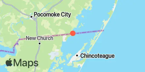
Franklin City Map
Latitude
38° 0' 24" N (38.0067)
Longitude
75° 22' 54" W (-75.3817)
State
County
Nearest ZIP
23356
Nearby
Tides
4.1 mi
Chincoteague Island, Blake Cove
4.7 mi
Jesters Island
4.8 mi
Chincoteague Island, Lewis Creek
4.9 mi
Chincoteague Island, Oyster Bay
5.2 mi
Chincoteague Island, USCG station
7.0 mi
Chincoteague Channel (South End), Chincoteague Bay
7.4 mi
Southern Chincoteague Island, Chincoteague Bay
9.8 mi
Assateague Beach, Toms Cove
10.5 mi
Wishart Point, Bogues Bay
11.1 mi
Public Landing, Chincoteague Bay
11.9 mi
Snow Hill, city park, Pocomoke River