Browns Bay Weekly Tide Tables and Charts
Tide Chart for Next 7 Days
Browns Bay weekly tide chart key:
The tide chart above shows the times and heights of high tide and low tide for Browns Bay, for the next seven days. The red line highlights the current time and estimated height.The tidal range at Browns Bay for the next seven days is approximately 2.52 ft with a minimum tide of 0.23 ft and maximum tide of 2.75 ft. You can also check out all the daily details on tides & fishing times on the Day tab for Browns Bay.
Tide Table for Next 7 Days
▲ Blue = High Tide
▼ Red = Low Tide
| Day | 1st Tide | 2nd Tide | 3rd Tide | 4th Tide | ☀ Sun |
Major Solunars
|
Minor Solunars
|
|
|---|---|---|---|---|---|---|---|---|
| 29 Wed |
|
▼ 0.45 ft |
▲ 2.3 ft |
▼ 0.52 ft |
▲ 2.71 ft |
▲ 6:08 AM ▼ 8:16 PM |
11:56 PM → 1:56 AM 12:14 PM → 2:14 PM |
5:25 AM → 6:25 AM 8:04 PM → 9:04 PM |
| 30 Thu |
|
▼ 0.35 ft |
▲ 2.39 ft |
▼ 0.49 ft |
▲ 2.7 ft |
▲ 6:09 AM ▼ 8:15 PM |
12:42 AM → 2:42 AM 12:59 PM → 2:59 PM |
6:27 AM → 7:27 AM 8:32 PM → 9:32 PM |
| 31 Fri |
|
▼ 0.28 ft |
▲ 2.47 ft |
▼ 0.5 ft |
▲ 2.67 ft |
▲ 6:09 AM ▼ 8:14 PM |
1:27 AM → 3:27 AM 1:43 PM → 3:43 PM |
7:30 AM → 8:30 AM 8:57 PM → 9:57 PM |
| 1 Sat |
|
▼ 0.24 ft |
▲ 2.55 ft |
▼ 0.55 ft |
▲ 2.61 ft |
▲ 6:10 AM ▼ 8:13 PM |
2:10 AM → 4:10 AM 2:26 PM → 4:26 PM |
8:32 AM → 9:32 AM 9:21 PM → 10:21 PM |
| 2 Sun |
|
▼ 0.23 ft |
▲ 2.63 ft |
▼ 0.62 ft |
▲ 6:11 AM ▼ 8:12 PM |
2:53 AM → 4:53 AM 3:09 PM → 5:09 PM |
9:35 AM → 10:35 AM 9:44 PM → 10:44 PM |
|
| 3 Mon |
|
▲ 2.53 ft |
▼ 0.25 ft |
▲ 2.7 ft |
▼ 0.7 ft |
▲ 6:12 AM ▼ 8:11 PM |
3:37 AM → 5:37 AM 3:54 PM → 5:54 PM |
10:39 AM → 11:39 AM 10:09 PM → 11:09 PM |
| 4 Tue |
|
▲ 2.44 ft |
▼ 0.3 ft |
▲ 2.75 ft |
▼ 0.77 ft |
▲ 6:13 AM ▼ 8:10 PM |
4:22 AM → 6:22 AM 4:41 PM → 6:41 PM |
11:45 AM → 12:45 PM 10:38 PM → 11:38 PM |
Buoy Weather
Air Temperature
82° F
Water Temperature
82° F
Wind
10 knots N (10°)
Wind Gust
11 knots
Atmospheric Pressure
1006 hPa
Note: Observations are from a weather buoy 6.66 miles from the prediction site. Observations are not available at all prediction sites, and observation types vary between sites.
More details: Station yktv2 Buoy Weather
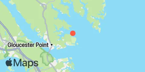
Location & Map
Latitude
37° 18' 0" N (37.3)
Longitude
76° 24' 0" W (-76.4)
State
County
Nearest ZIP
23072
Nearby
Tides
4.6 mi
Tue Marshes Light, York River
5.2 mi
Goodwin Neck, Yorktown, York River
5.9 mi
Mobjack, East River, Mobjack Bay
6.6 mi
Gloucester Point, York River
6.7 mi
Yorktown USCG Training Center, York River
8.0 mi
Belleville, Mobjack Bay
10.3 mi
Cheatham Annex, York River
Currents
3.7 mi
Tue Marshes Light, 0.7 n.mi. north of
4.3 mi
Tue Marshes Light, 0.9 n.mi. WNW of
4.4 mi
New Point Comfort, 2.0 n.mi. WSW of
5.0 mi
North edge of channel
5.2 mi
Midchannel
5.6 mi
South edge of channel
6.9 mi
Gloucester Point, 150 yds. southeast of
7.2 mi
Yorktown
7.2 mi
York River Ent. Channel (NW end)
7.4 mi
Gloucester Point, 0.4 mile southwest of
9.9 mi
Pages Rock, 1 mile SSE of
10.1 mi
York Spit Light, 0.8 mile southwest of
10.2 mi
Blundering Point, 0.9 mile SSW of
11.5 mi
New Point Comfort, 4.1 n.mi. ESE of
12.2 mi
Clay Bank Pier, 100 yds. southwest of
Note: Tide predictions are an estimate and NOT FOR NAVIGATION.
We also offer free widgets if you want to add tide or solunar tables to your own site.