Enbridge, Ingleside Weekly Tide Tables and Charts
Tide Chart for Next 7 Days
Enbridge, Ingleside weekly tide chart key:
The tide chart above shows the times and heights of high tide and low tide for Enbridge, Ingleside, for the next seven days. The red line highlights the current time and estimated height.The tidal range at Enbridge, Ingleside for the next seven days is approximately 0.77 ft with a minimum tide of -0.28 ft and maximum tide of 0.49 ft. You can also check out all the daily details on tides & fishing times on the Day tab for Enbridge, Ingleside.
Tide Table for Next 7 Days
▲ Blue = High Tide
▼ Red = Low Tide
| Day | 1st Tide | 2nd Tide | 3rd Tide | 4th Tide | ☀ Sun |
Major Solunars
|
Minor Solunars
|
|
|---|---|---|---|---|---|---|---|---|
| 31 Fri |
|
▼ -0.28 ft |
▲ 0.36 ft |
▲ 6:51 AM ▼ 8:19 PM |
1:53 AM → 3:53 AM 2:11 PM → 4:11 PM |
8:08 AM → 9:08 AM 9:14 PM → 10:14 PM |
||
| 1 Sat |
|
▼ -0.19 ft |
▲ 0.26 ft |
▲ 6:52 AM ▼ 8:18 PM |
2:36 AM → 4:36 AM 2:53 PM → 4:53 PM |
9:04 AM → 10:04 AM 9:43 PM → 10:43 PM |
||
| 2 Sun |
|
▼ -0.06 ft |
▲ 0.15 ft |
▼ 0.12 ft |
▲ 0.19 ft |
▲ 6:52 AM ▼ 8:17 PM |
3:19 AM → 5:19 AM 3:37 PM → 5:37 PM |
10:01 AM → 11:01 AM 10:13 PM → 11:13 PM |
| 3 Mon |
|
▼ 0.08 ft |
▲ 0.17 ft |
▼ -0.02 ft |
▲ 6:53 AM ▼ 8:17 PM |
4:02 AM → 6:02 AM 4:21 PM → 6:21 PM |
10:59 AM → 11:59 AM 10:44 PM → 11:44 PM |
|
| 4 Tue |
|
▲ 0.23 ft |
▼ 0.23 ft |
▲ 0.24 ft |
▼ -0.13 ft |
▲ 6:53 AM ▼ 8:16 PM |
4:48 AM → 6:48 AM 5:09 PM → 7:09 PM |
11:59 AM → 12:59 PM 11:19 PM → 12:19 AM |
| 5 Wed |
|
▲ 0.35 ft |
▼ -0.22 ft |
▲ 6:54 AM ▼ 8:15 PM |
5:37 AM → 7:37 AM 6:00 PM → 8:00 PM |
1:02 PM → 2:02 PM | ||
| 6 Thu |
|
▲ 0.44 ft |
▼ -0.28 ft |
▲ 6:55 AM ▼ 8:15 PM |
6:30 AM → 8:30 AM 6:56 PM → 8:56 PM |
11:58 PM → 12:58 AM 2:08 PM → 3:08 PM |
Buoy Weather
Air Temperature
84° F
Water Temperature
86° F
Wind
7 knots SSE (160°)
Wind Gust
12 knots
Atmospheric Pressure
1014 hPa
Note: Observations are from a weather buoy 0.81 miles from the prediction site. Observations are not available at all prediction sites, and observation types vary between sites.
More details: Station mhbt2 Buoy Weather
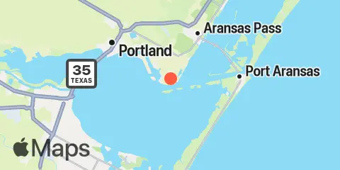
Location & Map
Latitude
27° 49' 7" N (27.81861111111111)
Longitude
97° 12' 32" W (-97.20894444444444)
State
County
Nearest ZIP
78336
Nearby
Tides
5.8 mi
La Quinta Channel North, Corpus Christi Bay
7.7 mi
Conn Brown Harbor, Aransas Pass
8.5 mi
Port Aransas
9.0 mi
Corpus Christi Naval Air Station
9.3 mi
Portland, Nueces Bay, Corpus Christi Bay
9.7 mi
Port Aransas (H. Caldwell Pier)
10.5 mi
Aransas, Aransas Pass
11.0 mi
Texas State Aquarium, Corpus Christi
Currents
0.1 mi
Enbridge
8.5 mi
Corpus Christi Channel UT Marine Science
9.3 mi
Harbor Island, Aransas Channel
9.7 mi
UTSMI Research Pier (midchannel)
9.7 mi
Lydia Ann Channel, S end
11.1 mi
Murray Shoal
Note: Tide predictions are an estimate and NOT FOR NAVIGATION.
We also offer free widgets if you want to add tide or solunar tables to your own site.