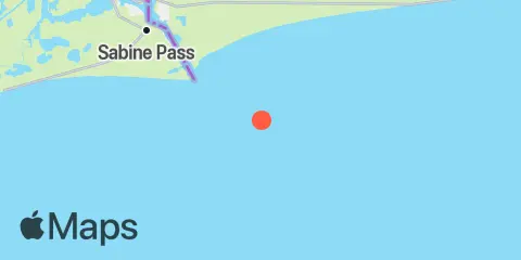
COX WC-53 Platform Weekly Tide Tables and Charts
Tide Chart for Next 7 Days
About this chart
COX WC-53 Platform weekly tide chart key:
The tide chart above shows the times and heights of high tide and low tide for COX WC-53 Platform, for the next seven days. The red line highlights the current time and estimated height.The tidal range at COX WC-53 Platform from through is approximately 2.83 ft, with a minimum tide of -0.02 ft and maximum tide of 2.81 ft. You can also check out all the daily details on tides & fishing times on the Day tab for COX WC-53 Platform.
Tide Table for Next 7 Days
▲ Blue = High Tide
▼ Red = Low Tide
| Day | Moon phase | 1st Tide | 2nd Tide | 3rd Tide | 4th Tide | ☀ Sun |
Major Times

|
Minor Times

|
|---|---|---|---|---|---|---|---|---|
 71% |
▼ -0.02 ft |
▲ 2.74 ft |
▲ 7:28 AM ▼ 6:29 PM |
5:03 AM → 7:03 AM 5:34 PM → 7:34 PM |
12:47 PM → 1:47 PM 11:21 PM → 12:21 AM |
|||
 50% |
▼ 0.2 ft |
▲ 2.66 ft |
▲ 6:28 AM ▼ 5:28 PM |
5:00 AM → 7:00 AM 5:30 PM → 7:30 PM |
12:32 PM → 1:32 PM 11:29 PM → 12:29 AM |
|||
 48% |
▼ 1.67 ft |
▲ 1.76 ft |
▼ 0.41 ft |
▲ 2.56 ft |
▲ 6:29 AM ▼ 5:28 PM |
5:53 AM → 7:53 AM 6:21 PM → 8:21 PM |
1:10 PM → 2:10 PM | |
|
37%
|
▼ 1.35 ft |
▲ 1.83 ft |
▼ 0.63 ft |
▲ 2.45 ft |
▲ 6:30 AM ▼ 5:27 PM |
6:42 AM → 8:42 AM 7:08 PM → 9:08 PM |
12:33 AM → 1:33 AM 1:43 PM → 2:43 PM |
|
|
27%
|
▼ 0.99 ft |
▲ 2.06 ft |
▼ 0.88 ft |
▲ 6:31 AM ▼ 5:26 PM |
7:27 AM → 9:27 AM 7:53 PM → 9:53 PM |
1:34 AM → 2:34 AM 2:13 PM → 3:13 PM |
||
|
18%
|
▲ 2.35 ft |
▼ 0.64 ft |
▲ 2.28 ft |
▼ 1.14 ft |
▲ 6:32 AM ▼ 5:25 PM |
8:12 AM → 10:12 AM 8:37 PM → 10:37 PM |
2:34 AM → 3:34 AM 2:43 PM → 3:43 PM |
|
|
11%
|
▲ 2.25 ft |
▼ 0.34 ft |
▲ 2.46 ft |
▼ 1.38 ft |
▲ 6:32 AM ▼ 5:25 PM |
8:55 AM → 10:55 AM 9:21 PM → 11:21 PM |
3:32 AM → 4:32 AM 3:12 PM → 4:12 PM |
About these predictions
Tide heights are predictions, not measurements. Wind, air pressure, storms, and river flow can cause actual water levels to differ. Not for navigation.
Tide prediction source:
NOAA
Vertical datum:
MLLW — Mean Lower Low Water
Add a free tide or fishing times widget for this station to your website.