Buck Hall Weekly Tide Tables and Charts
Tide Chart for Next 7 Days
Buck Hall weekly tide chart key:
The tide chart above shows the times and heights of high tide and low tide for Buck Hall, for the next seven days. The red line highlights the current time and estimated height.The tidal range at Buck Hall for the next seven days is approximately 5.32 ft with a minimum tide of 0.14 ft and maximum tide of 5.46 ft. You can also check out all the daily details on tides & fishing times on the Day tab for Buck Hall.
Tide Table for Next 7 Days
▲ Blue = High Tide
▼ Red = Low Tide
| Day | 1st Tide | 2nd Tide | 3rd Tide | 4th Tide | ☀ Sun |
Major Solunars
|
Minor Solunars
|
|
|---|---|---|---|---|---|---|---|---|
| 30 Thu |
|
▼ 0.4 ft |
▲ 4.45 ft |
▼ 0.34 ft |
▲ 5.31 ft |
▲ 6:30 AM ▼ 8:19 PM |
12:55 AM → 2:55 AM 1:13 PM → 3:13 PM |
6:49 AM → 7:49 AM 8:38 PM → 9:38 PM |
| 31 Fri |
|
▼ 0.28 ft |
▲ 4.66 ft |
▼ 0.33 ft |
▲ 5.26 ft |
▲ 6:31 AM ▼ 8:18 PM |
1:40 AM → 3:40 AM 1:57 PM → 3:57 PM |
7:49 AM → 8:49 AM 9:06 PM → 10:06 PM |
| 1 Sat |
|
▼ 0.2 ft |
▲ 4.87 ft |
▼ 0.36 ft |
▲ 5.16 ft |
▲ 6:32 AM ▼ 8:17 PM |
2:23 AM → 4:23 AM 2:40 PM → 4:40 PM |
8:48 AM → 9:48 AM 9:32 PM → 10:32 PM |
| 2 Sun |
|
▼ 0.15 ft |
▲ 5.07 ft |
▼ 0.43 ft |
▲ 5.02 ft |
▲ 6:32 AM ▼ 8:16 PM |
3:06 AM → 5:06 AM 3:23 PM → 5:23 PM |
9:48 AM → 10:48 AM 9:59 PM → 10:59 PM |
| 3 Mon |
|
▼ 0.14 ft |
▲ 5.24 ft |
▼ 0.53 ft |
▲ 6:33 AM ▼ 8:15 PM |
3:50 AM → 5:50 AM 4:08 PM → 6:08 PM |
10:49 AM → 11:49 AM 10:27 PM → 11:27 PM |
|
| 4 Tue |
|
▲ 4.83 ft |
▼ 0.14 ft |
▲ 5.36 ft |
▼ 0.64 ft |
▲ 6:34 AM ▼ 8:14 PM |
4:35 AM → 6:35 AM 4:55 PM → 6:55 PM |
11:52 AM → 12:52 PM 10:58 PM → 11:58 PM |
| 5 Wed |
|
▲ 4.63 ft |
▼ 0.16 ft |
▲ 5.46 ft |
▼ 0.71 ft |
▲ 6:34 AM ▼ 8:14 PM |
5:24 AM → 7:24 AM 5:46 PM → 7:46 PM |
12:58 PM → 1:58 PM |
Buoy Weather
Air Temperature
79° F
Wind
14 knots N (10°)
Wind Gust
19 knots
Atmospheric Pressure
1011 hPa
Note: Observations are from a weather buoy 16.81 miles from the prediction site. Observations are not available at all prediction sites, and observation types vary between sites.
More details: Station 41029 Buoy Weather
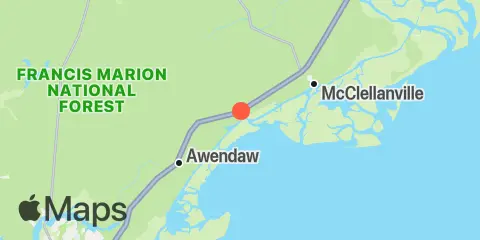
Location & Map
Latitude
33° 2' 24" N (33.04)
Longitude
79° 33' 36" W (-79.56)
State
County
Nearest ZIP
29458
Nearby
Tides
1.5 mi
Harbor River entrance, Bulls Bay
4.6 mi
Five Fathom Creek entrance, Bulls Bay
6.4 mi
McClellanville, Jeremy Creek, Bulls Bay
7.5 mi
Jack Creek entrance, Bulls Bay
9.0 mi
Moores Landing, ICWW, Sewee Bay
9.4 mi
Wharf Creek entrance, Bulls Bay
10.8 mi
Casino Creek, ICWW
12.3 mi
Cape Romain
12.3 mi
Price Creek, North Capers Island
Note: Tide predictions are an estimate and NOT FOR NAVIGATION.
We also offer free widgets if you want to add tide or solunar tables to your own site.