Oregon Inlet Marina Tides & Fishing Times
Tides
Oregon Inlet Marina tide chart key:
The tide chart above shows the times and heights of high tide and low tide for Oregon Inlet Marina, as well as solunar period times (represented by fish icons). The red line highlights the current time and estimated height.| Day | Time | Tide | Height | |
|---|---|---|---|---|
| 1 Sat | ▲ High | 1.15 ft | ||
| 2 Sun | ▼ Low | 0.33 ft | ||
| 2 Sun | ▲ High | 1 ft | ||
| 2 Sun | ▼ Low | 0.32 ft | ||
| 2 Sun | ▲ High | 1.12 ft | ||
| 3 Mon | ▼ Low | 0.33 ft |
Sunday, August 2, 2026 11:49 AM: The tide is currently falling at Oregon Inlet Marina with a current estimated height of 1 ft. The last tide was High at 11:00 AM and the next tide is a Low of 0.32 ft at 5:28 PM. The tidal range today is approximately 0.8 ft with a minimum tide of 0.32 ft and maximum tide of 1.12 ft.
Next 7 Days
▲ Blue = High Tide
▼ Red = Low Tide
| Day | 1st Tide | 2nd Tide | 3rd Tide | 4th Tide | ☀ Sun |
Major Solunars
|
Minor Solunars
|
|
|---|---|---|---|---|---|---|---|---|
| 2 Sun |
|
▼ 0.33 ft |
▲ 1 ft |
▼ 0.32 ft |
▲ 1.12 ft |
▲ 6:11 AM ▼ 8:06 PM |
2:50 AM → 4:50 AM 3:06 PM → 5:06 PM |
9:31 AM → 10:31 AM 9:42 PM → 10:42 PM |
| 3 Mon |
|
▼ 0.33 ft |
▲ 1.06 ft |
▼ 0.35 ft |
▲ 1.09 ft |
▲ 6:12 AM ▼ 8:05 PM |
3:33 AM → 5:33 AM 3:51 PM → 5:51 PM |
10:34 AM → 11:34 AM 10:08 PM → 11:08 PM |
| 4 Tue |
|
▼ 0.32 ft |
▲ 1.12 ft |
▼ 0.39 ft |
▲ 6:12 AM ▼ 8:04 PM |
4:18 AM → 6:18 AM 4:38 PM → 6:38 PM |
11:39 AM → 12:39 PM 10:37 PM → 11:37 PM |
|
| 5 Wed |
|
▲ 1.06 ft |
▼ 0.3 ft |
▲ 1.17 ft |
▼ 0.43 ft |
▲ 6:13 AM ▼ 8:03 PM |
5:07 AM → 7:07 AM 5:29 PM → 7:29 PM |
12:47 PM → 1:47 PM 11:11 PM → 12:11 AM |
| 6 Thu |
|
▲ 1.03 ft |
▼ 0.3 ft |
▲ 1.22 ft |
▼ 0.46 ft |
▲ 6:14 AM ▼ 8:02 PM |
6:00 AM → 8:00 AM 6:25 PM → 8:25 PM |
1:58 PM → 2:58 PM |
| 7 Fri |
|
▲ 1.01 ft |
▼ 0.29 ft |
▲ 1.28 ft |
▼ 0.48 ft |
▲ 6:15 AM ▼ 8:01 PM |
6:58 AM → 8:58 AM 7:27 PM → 9:27 PM |
11:53 PM → 12:53 AM 3:09 PM → 4:09 PM |
| 8 Sat |
|
▲ 1.01 ft |
▼ 0.28 ft |
▲ 1.35 ft |
▼ 0.46 ft |
▲ 6:16 AM ▼ --:-- |
8:01 AM → 10:01 AM 8:33 PM → 10:33 PM |
12:45 AM → 1:45 AM 4:19 PM → 5:19 PM |
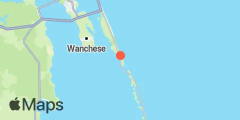
Location & Map
Latitude
35° 47' 42" N (35.795)
Longitude
75° 32' 53" W (-75.54806)
State
County
Nearest ZIP
27959
Nearby
Tides
1.6 mi
Oregon Inlet Bridge
1.6 mi
Oregon Inlet Channel
2.0 mi
Roanoke Sound Channel
2.2 mi
Oregon Inlet (USCG Station)
2.4 mi
Old House Channel
3.2 mi
Davis Slough
6.9 mi
Oyster Creek, Croatan Sound
8.3 mi
Jennettes Pier, Nags Head (Ocean)
8.6 mi
Roanoke Marshes Light, outer coast
Currents
1.5 mi
Bodie Island-Pea Island, between
1.7 mi
Herbert C. Bonner Bridge, WSW of
2.5 mi
Coast Guard Tower, southwest of
Note: Tide predictions are an estimate and NOT FOR NAVIGATION.
We also offer free widgets if you want to add tide or solunar tables to your own site.