Unfortunately, this tide station is no longer active, and predictions are no longer accurate.
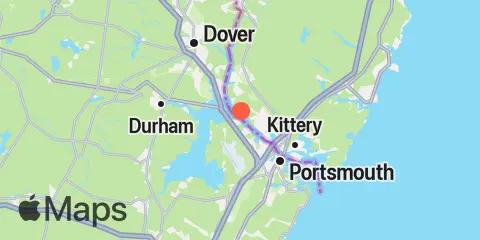
You can check out the map below -- any nearby locations will be displayed on the map and list below. Alternatively, you can browse the site for other active locations.
Location & Map
Latitude
43° 7' 0" N (43.1167)
Longitude
70° 48' 42" W (-70.8117)
State
County
Nearest ZIP
03801
Nearby
Tides
1.1 mi
Dover Point, Piscataqua River
3.1 mi
Atlantic Heights, Piscataqua River
4.0 mi
Portsmouth, Portsmouth Harbor
4.4 mi
Seavey Island, Portsmouth Harbor
5.2 mi
Salmon Falls River, Piscataqua River
6.0 mi
Kittery Point, Portsmouth Harbor
6.0 mi
Fort Point, Portsmouth Harbor
6.3 mi
Dover, Cocheco River, Piscataqua River
6.5 mi
Jaffrey Point, Portsmouth Harbor
6.7 mi
Squamscott River RR. Bridge, Piscataqua River
6.8 mi
Gerrish Island, Portsmouth Harbor
7.9 mi
Seapoint, Cutts Island
8.6 mi
York Harbor
8.8 mi
Fort Point, York Harbor
11.5 mi
Cape Neddick
Currents
0.4 mi
Frankfort Island, south of
0.7 mi
General Sullivan Bridge
1.3 mi
Dover Point, west of
2.0 mi
Schiller Station
2.3 mi
Goat Island and Fox Point, between
2.4 mi
Goat Island, north of
2.4 mi
Knight Hill Township, west of
2.8 mi
I-95 Bridge
3.1 mi
Furber Strait
3.2 mi
Sara Long Bridge
4.0 mi
Memorial Bridge
4.2 mi
Portsmouth Harbor, Gangway Rocks LB13
4.5 mi
Pierces Island, northeast of
4.7 mi
Henderson Point, west of
4.8 mi
Henderson Point, SSW of
4.9 mi
Shapleigh Island Bridge, south of
5.1 mi
Clark Island, southwest of
5.3 mi
Clark Island, south of
5.5 mi
Salamander Point, north of
6.0 mi
Fort Point
6.4 mi
Wood Island, northwest of
6.4 mi
Little Harbor entrance
6.6 mi
Portsmouth Harbor Entrance
6.8 mi
Whaleback Reef, west of
7.2 mi
Odiornes Point, northeast of
7.4 mi
Odiornes Point, NNE of
