Chatham Tides & Fishing Times
Tides
Chatham tide chart key:
The tide chart above shows the times and heights of high tide and low tide for Chatham, as well as solunar period times (represented by fish icons). The red line highlights the current time and estimated height.| Day | Time | Tide | Height | |
|---|---|---|---|---|
| 29 Wed | ▼ Low | 1.03 ft | ||
| 30 Thu | ▲ High | 4.42 ft | ||
| 30 Thu | ▼ Low | 0.59 ft | ||
| 30 Thu | ▲ High | 3.49 ft | ||
| 30 Thu | ▼ Low | 0.94 ft | ||
| 31 Fri | ▲ High | 4.42 ft |
Thursday, July 30, 2026 4:55 AM: The tide is currently falling at Chatham with a current estimated height of 1.7 ft. The last tide was High at 1:02 AM and the next tide is a Low of 0.59 ft at 7:05 AM. The tidal range today is approximately 3.83 ft with a minimum tide of 0.59 ft and maximum tide of 4.42 ft.
Next 7 Days
▲ Blue = High Tide
▼ Red = Low Tide
| Day | 1st Tide | 2nd Tide | 3rd Tide | 4th Tide | ☀ Sun |
Major Solunars
|
Minor Solunars
|
|
|---|---|---|---|---|---|---|---|---|
| 30 Thu |
|
▲ 4.42 ft |
▼ 0.59 ft |
▲ 3.49 ft |
▼ 0.94 ft |
▲ 5:32 AM ▼ --:-- |
12:16 AM → 2:16 AM 12:32 PM → 2:32 PM |
5:51 AM → 6:51 AM 8:13 PM → 9:13 PM |
| 31 Fri |
|
▲ 4.42 ft |
▼ 0.52 ft |
▲ 3.65 ft |
▼ 0.83 ft |
▲ 5:33 AM ▼ 7:59 PM |
1:00 AM → 3:00 AM 1:16 PM → 3:16 PM |
6:57 AM → 7:57 AM 8:35 PM → 9:35 PM |
| 1 Sat |
|
▲ 4.39 ft |
▼ 0.46 ft |
▲ 3.86 ft |
▼ 0.7 ft |
▲ 5:34 AM ▼ 7:58 PM |
1:44 AM → 3:44 AM 1:59 PM → 3:59 PM |
8:02 AM → 9:02 AM 8:56 PM → 9:56 PM |
| 2 Sun |
|
▲ 4.33 ft |
▼ 0.42 ft |
▲ 4.08 ft |
▼ 0.56 ft |
▲ 5:35 AM ▼ 7:56 PM |
2:27 AM → 4:27 AM 2:42 PM → 4:42 PM |
9:08 AM → 10:08 AM 9:16 PM → 10:16 PM |
| 3 Mon |
|
▲ 4.23 ft |
▼ 0.42 ft |
▲ 4.31 ft |
▼ 0.43 ft |
▲ 5:36 AM ▼ 7:55 PM |
3:10 AM → 5:10 AM 3:26 PM → 5:26 PM |
10:15 AM → 11:15 AM 9:38 PM → 10:38 PM |
| 4 Tue |
|
▲ 4.08 ft |
▼ 0.45 ft |
▲ 4.51 ft |
▼ 0.32 ft |
▲ 5:37 AM ▼ 7:54 PM |
3:55 AM → 5:55 AM 4:14 PM → 6:14 PM |
11:25 AM → 12:25 PM 10:03 PM → 11:03 PM |
| 5 Wed |
|
▲ 3.91 ft |
▼ 0.51 ft |
▲ 4.68 ft |
▲ 5:38 AM ▼ 7:53 PM |
4:44 AM → 6:44 AM 5:05 PM → 7:05 PM |
12:37 PM → 1:37 PM 10:33 PM → 11:33 PM |
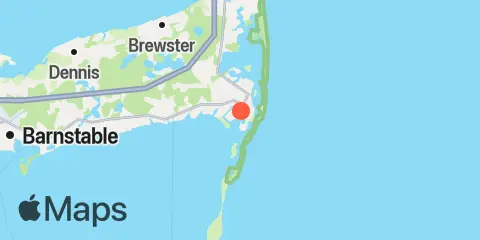
Location & Map
Latitude
41° 40' 0" N (41.6667)
Longitude
69° 58' 0" W (-69.9667)
State
County
Nearest ZIP
02633
Nearby
Tides
1.7 mi
Chatham, Cape Cod
4.7 mi
Saquatucket Harbor, Nantucket Sound
4.9 mi
Pleasant Bay, Cape Cod
5.1 mi
Wychmere Harbor, Nantucket Sound
7.7 mi
Dennisport, Nantucket Sound
11.2 mi
South Yarmouth, Bass River, Nantucket Sound
11.4 mi
Sesuit Harbor, East Dennis, Cape Cod Bay
Currents
0.8 mi
Stage Harbor, west of Morris Island
7.4 mi
Pollock Rip Channel, east end
8.1 mi
Pollock Rip Channel (Butler Hole)
8.4 mi
Dennis Port, 2.2 miles south of
8.6 mi
Monomoy Pt., channel 0.2 mile west of
12.1 mi
Monomoy Point, 6 miles west of
Note: Tide predictions are an estimate and NOT FOR NAVIGATION.
We also offer free widgets if you want to add tide or solunar tables to your own site.