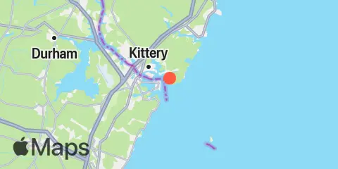
TidesPro
  • Recents
    • Gerrish Island, Portsmouth Harbor
  • Tides
    United States
    Alabama Alaska California Connecticut Delaware District of Columbia Florida Georgia Hawaii
    Louisiana Maine Maryland Massachusetts Mississippi New Hampshire New Jersey New York North Carolina
    Oregon Pennsylvania Rhode Island South Carolina Texas US Outlying Islands Virginia Washington Puerto Rico
    Caribbean
    The Bahamas Cayman Islands Cuba Dominican Republic Haiti Jamaica Virgin Islands (US)
  • Fishing  Coordinates
    Alabama - Alabama Inshore Public Reefs Alabama - Alabama Nearshore Public Reefs Alabama - Alabama Offshore Public Reefs California - California Artificial Reefs Delaware - Delaware Artificial Reefs Florida - Bay County Florida - Brevard County Florida - Broward County Florida - Charlote and Lee Counties Florida - Citrus County Florida - Collier County Florida - Dixie County Florida - Duval County Florida - Escambia County Florida - Flagler County Florida - Florida Keys Florida - Franklin County Florida - Gulf County Florida - Hernando County
    Florida - Indian River County Florida - Levy County Florida - Manatee County Florida - Martin County Florida - Miami-Dade County Florida - Monroe County Florida - Nassau County Florida - Okaloosa County Florida - Palm Beach County Florida - Pasco County Florida - Santa Rosa County Florida - Sarasota County Florida - St. Johns County Florida - St. Lucie County Florida - Tampa Bay Florida - Taylor County Florida - Volusia County Florida - Wakulla County Florida - Walton County
    Georgia - Georgia Reefs Hawaii - Hawaii Artificial Reefs Louisiana - Louisiana Artificial Reefs Maryland - Maryland Artificial Reefs Massachusetts - Massachusetts Artificial Reefs Mississippi - Mississippi Inshore Artificial Reefs Mississippi - Mississippi Offshore Artificial Reefs New Jersey - New Jersey Artificial Reefs New York - New York Artificial Reefs North Carolina - Estuarine North Carolina - Long Bay North Carolina - Onslow Bay North Carolina - Outer Banks North Carolina - Raleigh Bay Puerto Rico - Puerto Rico Artificial Reefs Rhode Island - Rhode Island Artificial Reefs South Carolina - South Carolina Reefs Texas - Texas Artificial Reefs Virginia - Virginia Artificial Reefs
  • Solunar Tables
Gerrish Island Location
  1. United States
  2. Maine
  3. Gerrish Island, Portsmouth Harbor

Gerrish Island Map

Day Week Month Table Month Chart Map
Latitude
43° 4' 0" N (43.0667)
Longitude
70° 41' 48" W (-70.6967)
State
Maine
County
York County
Nearest ZIP
03905
Nearby
Tides 0.8 mi Fort Point, Portsmouth Harbor 1.1 mi Jaffrey Point, Portsmouth Harbor 1.1 mi Kittery Point, Portsmouth Harbor 2.2 mi Seapoint, Cutts Island 2.4 mi Seavey Island, Portsmouth Harbor 2.9 mi Portsmouth, Portsmouth Harbor 3.7 mi Atlantic Heights, Piscataqua River 5.3 mi Fort Point, York Harbor 5.3 mi York Harbor 7.4 mi Gosport Harbor, Isles of Shoals 7.9 mi Dover Point, Piscataqua River 8.7 mi Cape Neddick 10.8 mi Salmon Falls River, Piscataqua River 11.0 mi Squamscott River RR. Bridge, Piscataqua River Currents 0.4 mi Wood Island, northwest of 0.5 mi Portsmouth Harbor Entrance 0.7 mi Whaleback Reef, west of 0.7 mi Fort Point 1.2 mi Odiornes Point, northeast of 1.2 mi Salamander Point, north of 1.2 mi Little Harbor entrance 1.5 mi Clark Island, south of 1.7 mi Odiornes Point, NNE of 1.7 mi Clark Island, southwest of 2.1 mi Shapleigh Island Bridge, south of 2.2 mi Henderson Point, SSW of 2.2 mi Henderson Point, west of 2.3 mi Pierces Island, northeast of 2.7 mi Portsmouth Harbor, Gangway Rocks LB13 2.9 mi Memorial Bridge 3.6 mi Sara Long Bridge 4.0 mi I-95 Bridge 4.8 mi Schiller Station 6.4 mi Frankfort Island, south of 7.4 mi General Sullivan Bridge 8.0 mi Dover Point, west of 8.5 mi Furber Strait 8.6 mi Knight Hill Township, west of 9.0 mi Goat Island and Fox Point, between 9.1 mi Goat Island, north of

About

TidesPro was created as an easy-to-use tides and solunar site. It provides tide predictions and marine weather for many types of people, whether you’re fishing, going to the beach, boating, kayaking, surfing, or planning a trip. With anglers in mind, it also provides an accessible way to find fishing spots and the best times to fish in those locations.

More About TidesPro

App

Apple App Store
[More Info]
Quick Links
  • When to Fish
  • Solunar Theory
  • Tide & Solunar Widgets for Your Site
  • Tide & Solunar Predictions in Google Earth
  • Things to Do
  • About

© Copyright 2017 - 2025 ASR Concepts LLC. All rights reserved.

  • Privacy Policy
  • •
  • Terms of Use
  • •
  • Contact
  • •
  • Bluesky
  • •
  • Mastodon