Castine Tides & Fishing Times
Tides
Castine tide chart key:
The tide chart above shows the times and heights of high tide and low tide for Castine, as well as solunar period times (represented by fish icons). The red line highlights the current time and estimated height.| Day | Time | Tide | Height | |
|---|---|---|---|---|
| 31 Fri | ▼ Low | 1.15 ft | ||
| 1 Sat | ▲ High | 10.77 ft | ||
| 1 Sat | ▼ Low | 0.18 ft | ||
| 1 Sat | ▲ High | 10.14 ft | ||
| 1 Sat | ▼ Low | 0.99 ft | ||
| 2 Sun | ▲ High | 10.7 ft |
Saturday, August 1, 2026 9:58 PM: The tide is currently rising at Castine with a current estimated height of 4.1 ft. The last tide was Low at 7:39 PM and the next tide is a High of 10.7 ft at 1:48 AM. The tidal range today is approximately 10.59 ft with a minimum tide of 0.18 ft and maximum tide of 10.77 ft.
Next 7 Days
▲ Blue = High Tide
▼ Red = Low Tide
| Day | 1st Tide | 2nd Tide | 3rd Tide | 4th Tide | ☀ Sun |
Major Solunars
|
Minor Solunars
|
|
|---|---|---|---|---|---|---|---|---|
| 1 Sat |
|
▲ 10.77 ft |
▼ 0.18 ft |
▲ 10.14 ft |
▼ 0.99 ft |
▲ 5:22 AM ▼ --:-- |
1:39 AM → 3:39 AM 1:53 PM → 3:53 PM |
7:55 AM → 8:55 AM 8:52 PM → 9:52 PM |
| 2 Sun |
|
▲ 10.7 ft |
▼ 0.19 ft |
▲ 10.37 ft |
▼ 0.83 ft |
▲ 5:23 AM ▼ 7:59 PM |
2:22 AM → 4:22 AM 2:36 PM → 4:36 PM |
9:03 AM → 10:03 AM 9:10 PM → 10:10 PM |
| 3 Mon |
|
▲ 10.54 ft |
▼ 0.27 ft |
▲ 10.57 ft |
▼ 0.69 ft |
▲ 5:25 AM ▼ 7:57 PM |
3:05 AM → 5:05 AM 3:21 PM → 5:21 PM |
10:13 AM → 11:13 AM 9:30 PM → 10:30 PM |
| 4 Tue |
|
▲ 10.3 ft |
▼ 0.43 ft |
▲ 10.72 ft |
▼ 0.6 ft |
▲ 5:26 AM ▼ 7:56 PM |
3:51 AM → 5:51 AM 4:08 PM → 6:08 PM |
11:25 AM → 12:25 PM 9:52 PM → 10:52 PM |
| 5 Wed |
|
▲ 9.99 ft |
▼ 0.66 ft |
▲ 10.79 ft |
▼ 0.55 ft |
▲ 5:27 AM ▼ 7:55 PM |
4:39 AM → 6:39 AM 4:59 PM → 6:59 PM |
12:40 PM → 1:40 PM 10:19 PM → 11:19 PM |
| 6 Thu |
|
▲ 9.65 ft |
▼ 0.93 ft |
▲ 10.81 ft |
▼ 0.51 ft |
▲ 5:28 AM ▼ 7:53 PM |
5:32 AM → 7:32 AM 5:56 PM → 7:56 PM |
1:57 PM → 2:57 PM 10:55 PM → 11:55 PM |
| 7 Fri |
|
▲ 9.38 ft |
▼ 1.15 ft |
▲ 10.85 ft |
▲ 5:29 AM ▼ 7:52 PM |
6:30 AM → 8:30 AM 6:57 PM → 8:57 PM |
3:14 PM → 4:14 PM |
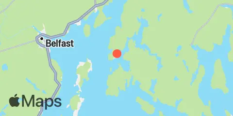
Location & Map
Latitude
44° 23' 12" N (44.3867)
Longitude
68° 47' 48" W (-68.7967)
State
County
Nearest ZIP
04420
Nearby
Tides
5.9 mi
Fort Point, Penobscot River
8.2 mi
Sandy Point, Penobscot River
8.3 mi
Little Deer Isle, Eggemoggin Reach
10.5 mi
Gross Point, Eastern Channel, Penobscot River
10.7 mi
Belfast, Penobscot Bay
11.6 mi
Blue Hill Harbor, Blue Hill Bay
Currents
0.4 mi
Hosmer Ledge, Castine Harbor
2.5 mi
Dice Head, west of, Penobscot Bay
3.0 mi
Turtle Head Pt., ESE of, Penobscot Bay
3.3 mi
Jones Point, Bagaduce River
5.1 mi
Head of the Cape, NNW of, Penobscot Bay
5.2 mi
Head of the Cape, 0.8 nmi. W, of Penobscot Bay
5.4 mi
Fort Point Ledge, Penobscot Bay
5.8 mi
Pumpkin Island, north of
6.1 mi
Birch Island, northwest of
6.3 mi
Islesboro Harbor, NE of, Penobscot Bay
6.3 mi
Ram Island, west of, West Penobscot Bay
6.4 mi
Islesboro Harbor, NE of, Penobscot Bay
6.5 mi
Temple Heights, NE of, W Penobscot Bay
6.6 mi
Pond Island-Western Island, between
7.5 mi
Temple Heights, NNE of, W Penobscot Bay
7.7 mi
Swains Ledge, 0.3 nautical mile SW of
7.7 mi
Hog Island, ESE of
8.1 mi
Flat Island, SSW of
8.2 mi
Little Deer I.-Sheep I., between
8.4 mi
Little Eaton Island, NNE of
9.0 mi
Pickering Island, south of
9.0 mi
Odom Ledge, Penobscot River
9.3 mi
Ducktrap Harbor, northeast of
9.7 mi
Ducktrap Harbor, NNE of
9.8 mi
Ducktrap Harbor, NNE of
10.4 mi
Great Spruce Head Island, west of
10.9 mi
Warren Island, northwest of
11.0 mi
Bradbury Island, ESE of
11.4 mi
Butter I., 0.3 nautical mile SE of
11.6 mi
Scrag Island, 0.3 nautical mile SW of
12.1 mi
Compass Island, 0.4 nmi. ENE of
12.1 mi
Penobscot Narrows Bridge
Note: Tide predictions are an estimate and NOT FOR NAVIGATION.
We also offer free widgets if you want to add tide or solunar tables to your own site.