Toms Harbor Channel Tides & Fishing Times
Tides
Toms Harbor Channel tide chart key:
The tide chart above shows the times and heights of high tide and low tide for Toms Harbor Channel, as well as solunar period times (represented by fish icons). The red line highlights the current time and estimated height.| Day | Time | Tide | Height | |
|---|---|---|---|---|
| 1 Sat | ▼ Low | 0.06 ft | ||
| 2 Sun | ▲ High | 0.58 ft | ||
| 2 Sun | ▼ Low | 0.15 ft | ||
| 2 Sun | ▲ High | 0.66 ft | ||
| 2 Sun | ▼ Low | 0.1 ft | ||
| 3 Mon | ▲ High | 0.62 ft |
Sunday, August 2, 2026 11:49 AM: The tide is currently rising at Toms Harbor Channel with a current estimated height of 0.2 ft. The last tide was Low at 11:14 AM and the next tide is a High of 0.66 ft at 6:11 PM. The tidal range today is approximately 0.56 ft with a minimum tide of 0.1 ft and maximum tide of 0.66 ft.
Next 7 Days
▲ Blue = High Tide
▼ Red = Low Tide
| Day | 1st Tide | 2nd Tide | 3rd Tide | 4th Tide | ☀ Sun |
Major Solunars
|
Minor Solunars
|
|
|---|---|---|---|---|---|---|---|---|
| 2 Sun |
|
▲ 0.58 ft |
▼ 0.15 ft |
▲ 0.66 ft |
▼ 0.1 ft |
▲ 6:52 AM ▼ 8:07 PM |
3:12 AM → 5:12 AM 3:30 PM → 5:30 PM |
9:53 AM → 10:53 AM 10:08 PM → 11:08 PM |
| 3 Mon |
|
▲ 0.62 ft |
▼ 0.13 ft |
▲ 0.59 ft |
▲ 6:53 AM ▼ 8:07 PM |
3:55 AM → 5:55 AM 4:14 PM → 6:14 PM |
10:49 AM → 11:49 AM 10:40 PM → 11:40 PM |
|
| 4 Tue |
|
▼ 0.14 ft |
▲ 0.65 ft |
▼ 0.11 ft |
▲ 0.5 ft |
▲ 6:53 AM ▼ 8:06 PM |
4:41 AM → 6:41 AM 5:01 PM → 7:01 PM |
11:47 AM → 12:47 PM 11:16 PM → 12:16 AM |
| 5 Wed |
|
▼ 0.18 ft |
▲ 0.67 ft |
▼ 0.08 ft |
▲ 0.42 ft |
▲ 6:54 AM ▼ 8:05 PM |
5:29 AM → 7:29 AM 5:52 PM → 7:52 PM |
12:48 PM → 1:48 PM |
| 6 Thu |
|
▼ 0.22 ft |
▲ 0.7 ft |
▼ 0.05 ft |
▲ 0.35 ft |
▲ 6:54 AM ▼ 8:05 PM |
6:23 AM → 8:23 AM 6:49 PM → 8:49 PM |
11:57 PM → 12:57 AM 1:53 PM → 2:53 PM |
| 7 Fri |
|
▼ 0.24 ft |
▲ 0.72 ft |
▼ 0.01 ft |
▲ 6:55 AM ▼ 8:04 PM |
7:21 AM → 9:21 AM 7:50 PM → 9:50 PM |
12:45 AM → 1:45 AM 3:00 PM → 4:00 PM |
|
| 8 Sat |
|
▲ 0.33 ft |
▼ 0.26 ft |
▲ 0.75 ft |
▼ -0.02 ft |
▲ 6:55 AM ▼ 8:03 PM |
8:23 AM → 10:23 AM 8:55 PM → 10:55 PM |
1:41 AM → 2:41 AM 4:07 PM → 5:07 PM |
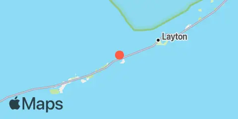
Location & Map
Latitude
24° 46' 36" N (24.7767)
Longitude
80° 55' 24" W (-80.9233)
State
County
Nearest ZIP
33050
Nearby
Tides
1.0 mi
Duck Key, Hawk Channel
1.1 mi
Grassy Key, north side, Florida Bay
1.1 mi
Toms Harbor Cut
2.7 mi
Grassy Key, south side, Hawk Channel
2.7 mi
Conch Key, eastern end
5.0 mi
Long Key, western end
6.6 mi
Fat Deer Key, Florida Bay
7.1 mi
Key Colony Beach
7.3 mi
Long Key Lake, Long Key
7.4 mi
Vaca Key-Fat Deer Key bridge
8.1 mi
Long Key Bight, Long Key
8.9 mi
Jewfish Hole, Long Key, Florida Bay
10.0 mi
Channel Five, west side, Hawk Channel
10.7 mi
Channel Five, East Side, Hawk Channel
11.6 mi
Channel Two, west side, Hawk Channel
12.0 mi
Channel Two, east, Lower Matecumbe Key, Fla. Bay
12.4 mi
Vaca Key, Florida Bay
Currents
4.0 mi
Long Key Viaduct
10.6 mi
Long Key, drawbridge east of
Note: Tide predictions are an estimate and NOT FOR NAVIGATION.
We also offer free widgets if you want to add tide or solunar tables to your own site.