Viekoda Bay Tides & Fishing Times
Tides
Viekoda Bay tide chart key:
The tide chart above shows the times and heights of high tide and low tide for Viekoda Bay, as well as solunar period times (represented by fish icons). The red line highlights the current time and estimated height.| Day | Time | Tide | Height | |
|---|---|---|---|---|
| 1 Sat | ▼ Low | 1.1 ft | ||
| 2 Sun | ▲ High | 14.31 ft | ||
| 2 Sun | ▼ Low | -0.8 ft | ||
| 2 Sun | ▲ High | 14.66 ft | ||
| 2 Sun | ▼ Low | 1.02 ft | ||
| 3 Mon | ▲ High | 13.55 ft |
Sunday, August 2, 2026 7:45 AM: The tide is currently falling at Viekoda Bay with a current estimated height of 8.6 ft. The last tide was High at 5:07 AM and the next tide is a Low of -0.8 ft at 11:27 AM. The tidal range today is approximately 15.46 ft with a minimum tide of -0.8 ft and maximum tide of 14.66 ft.
Next 7 Days
▲ Blue = High Tide
▼ Red = Low Tide
| Day | 1st Tide | 2nd Tide | 3rd Tide | 4th Tide | ☀ Sun |
Major Solunars
|
Minor Solunars
|
|
|---|---|---|---|---|---|---|---|---|
| 2 Sun |
|
▲ 14.31 ft |
▼ -0.8 ft |
▲ 14.66 ft |
▼ 1.02 ft |
▲ 6:09 AM ▼ 10:27 PM |
4:09 AM → 6:09 AM 4:20 PM → 6:20 PM |
11:01 AM → 12:01 PM 10:40 PM → 11:40 PM |
| 3 Mon |
|
▲ 13.55 ft |
▼ 0.25 ft |
▲ 14.53 ft |
▲ 6:11 AM ▼ 10:25 PM |
4:53 AM → 6:53 AM 5:05 PM → 7:05 PM |
12:27 PM → 1:27 PM 10:43 PM → 11:43 PM |
|
| 4 Tue |
|
▼ 1.13 ft |
▲ 12.55 ft |
▼ 1.57 ft |
▲ 14.26 ft |
▲ 6:13 AM ▼ 10:23 PM |
5:39 AM → 7:39 AM 5:52 PM → 7:52 PM |
1:56 PM → 2:56 PM 10:49 PM → 11:49 PM |
| 5 Wed |
|
▼ 1.42 ft |
▲ 11.42 ft |
▼ 3.04 ft |
▲ 13.84 ft |
▲ 6:16 AM ▼ 10:20 PM |
6:28 AM → 8:28 AM 6:49 PM → 8:49 PM |
3:30 PM → 4:30 PM 10:58 PM → 11:58 PM |
| 6 Thu |
|
▼ 1.76 ft |
▲ 10.42 ft |
▼ 4.48 ft |
▲ 13.39 ft |
▲ 6:18 AM ▼ 10:18 PM |
7:22 AM → 9:22 AM 7:48 PM → 9:48 PM |
5:22 PM → 6:22 PM 11:14 PM → 12:14 AM |
| 7 Fri |
|
▼ 1.87 ft |
▲ 10.02 ft |
▼ 5.52 ft |
▲ 13.15 ft |
▲ 6:20 AM ▼ 10:15 PM |
8:22 AM → 10:22 AM 8:52 PM → 10:52 PM |
6:59 PM → 7:59 PM |
| 8 Sat |
|
▼ 1.36 ft |
▲ 10.6 ft |
▼ 5.64 ft |
▲ 13.48 ft |
▲ 6:22 AM ▼ 10:13 PM |
9:25 AM → 11:25 AM 10:00 PM → 12:00 AM |
11:46 PM → 12:46 AM 8:13 PM → 9:13 PM |
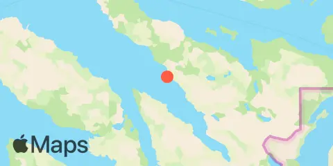
Location & Map
Latitude
57° 54' 0" N (57.9)
Longitude
153° 10' 0" W (-153.16667)
State
County
Nearest ZIP
99550
Nearby
Tides
6.0 mi
Dry Spruce Island, Kupreanof Strait
8.5 mi
Uganik Passage, Uganik Bay
10.4 mi
Nachalni Island, Kupreanof Strait
10.7 mi
Onion Bay, Kupreanof Strait
10.8 mi
Terror Bay (southwest), Kodiak Island
11.2 mi
Port Lions, Kodiak Island
11.3 mi
Kizhuyak Bay
Currents
6.8 mi
2.5nm east of Outlet Cape
10.6 mi
Chernof Point, 0.8mile off
11.5 mi
Whale Passage, Northwest Entrance
Note: Tide predictions are an estimate and NOT FOR NAVIGATION.
We also offer free widgets if you want to add tide or solunar tables to your own site.