Redfox Bay Tides & Fishing Times
Tides
Redfox Bay tide chart key:
The tide chart above shows the times and heights of high tide and low tide for Redfox Bay, as well as solunar period times (represented by fish icons). The red line highlights the current time and estimated height.| Day | Time | Tide | Height | |
|---|---|---|---|---|
| 1 Sat | ▼ Low | 1.18 ft | ||
| 2 Sun | ▲ High | 13.49 ft | ||
| 2 Sun | ▼ Low | -1.2 ft | ||
| 2 Sun | ▲ High | 13.93 ft | ||
| 2 Sun | ▼ Low | 1.07 ft | ||
| 3 Mon | ▲ High | 12.54 ft |
Sunday, August 2, 2026 7:46 AM: The tide is currently falling at Redfox Bay with a current estimated height of 7.8 ft. The last tide was High at 5:04 AM and the next tide is a Low of -1.2 ft at 11:28 AM. The tidal range today is approximately 15.13 ft with a minimum tide of -1.2 ft and maximum tide of 13.93 ft.
Next 7 Days
▲ Blue = High Tide
▼ Red = Low Tide
| Day | 1st Tide | 2nd Tide | 3rd Tide | 4th Tide | ☀ Sun |
Major Solunars
|
Minor Solunars
|
|
|---|---|---|---|---|---|---|---|---|
| 2 Sun |
|
▲ 13.49 ft |
▼ -1.2 ft |
▲ 13.93 ft |
▼ 1.07 ft |
▲ 6:04 AM ▼ 10:28 PM |
4:07 AM → 6:07 AM 4:18 PM → 6:18 PM |
10:59 AM → 11:59 AM 10:37 PM → 11:37 PM |
| 3 Mon |
|
▲ 12.54 ft |
▼ 0.11 ft |
▲ 13.77 ft |
▲ 6:06 AM ▼ 10:26 PM |
4:50 AM → 6:50 AM 5:02 PM → 7:02 PM |
12:26 PM → 1:26 PM 10:39 PM → 11:39 PM |
|
| 4 Tue |
|
▼ 1.22 ft |
▲ 11.29 ft |
▼ 1.76 ft |
▲ 13.42 ft |
▲ 6:08 AM ▼ 10:23 PM |
5:36 AM → 7:36 AM 5:50 PM → 7:50 PM |
1:56 PM → 2:56 PM 10:44 PM → 11:44 PM |
| 5 Wed |
|
▼ 1.58 ft |
▲ 9.88 ft |
▼ 3.6 ft |
▲ 12.9 ft |
▲ 6:10 AM ▼ 10:21 PM |
6:26 AM → 8:26 AM 6:47 PM → 8:47 PM |
3:31 PM → 4:31 PM 10:51 PM → 11:51 PM |
| 6 Thu |
|
▼ 2 ft |
▲ 8.63 ft |
▼ 5.4 ft |
▲ 12.34 ft |
▲ 6:13 AM ▼ 10:18 PM |
7:20 AM → 9:20 AM 7:45 PM → 9:45 PM |
5:26 PM → 6:26 PM 11:05 PM → 12:05 AM |
| 7 Fri |
|
▼ 2.14 ft |
▲ 8.12 ft |
▼ 6.7 ft |
▲ 12.04 ft |
▲ 6:15 AM ▼ 10:16 PM |
8:19 AM → 10:19 AM 8:49 PM → 10:49 PM |
7:04 PM → 8:04 PM |
| 8 Sat |
|
▼ 1.5 ft |
▲ 8.86 ft |
▼ 6.86 ft |
▲ 12.44 ft |
▲ 6:17 AM ▼ 10:14 PM |
9:22 AM → 11:22 AM 9:58 PM → 11:58 PM |
11:35 PM → 12:35 AM 8:19 PM → 9:19 PM |
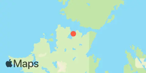
Location & Map
Latitude
58° 27' 12" N (58.4533)
Longitude
152° 35' 42" W (-152.595)
State
County
Nearest ZIP
99615
Nearby
Tides
7.1 mi
Big Bay, Shuyak Island
7.9 mi
Andreon Bay, Shuyak Island
8.5 mi
Perenosa Bay, Afognak Island
9.7 mi
Carry Inlet, Shuyak Island
Currents
3.5 mi
Lighthouse Point, Shuyak Island
3.7 mi
Cape Current Narrows, Shuyak Strait
6.1 mi
East Shuyak Strait Entrance
8.4 mi
Alligator Island, Shelikof Strait
11.8 mi
Black Cape, Shelikof Strait
Note: Tide predictions are an estimate and NOT FOR NAVIGATION.
We also offer free widgets if you want to add tide or solunar tables to your own site.