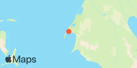
Port Moller Fishing Times
Check tides for fishing in Port Moller, alongside major and minor solunar periods and a seven-day fishing outlook.
Major solunar periods
Low tide · 7:15 AM · 5.2 ft
Low tide · 7:04 PM · -0.55 ft
Based on solunar timing. Consider weather and water conditions.
Tides & fishing windows
Full tide details →Shaded bands show major fishing periods. Fish markers show all major and minor periods.
Fishing times
Major Fishing Times
3:42 AM 5:42 AM
4:11 PM 6:11 PM
Minor Fishing Times
12:34 AM 1:34 AM
7:41 AM 8:41 AM
About Solunar Theory →Tide Times & Heights
| Tide | Time | Height |
|---|---|---|
| High tide | 9.91′ | |
| Low tide | 5.20′ | |
| High tide | 8.32′ | |
| Low tide | -0.55′ |
Weather & marine conditions
Friday, April 9, 2027
Forecast unavailable for this selection.
Atmospheric pressure
Pressure forecasts are currently unavailable for this date.
Sun & moon
Moon phase
 Waxing Crescent
10% illuminated
Sun & moon
- Sunrise
- Sunset
- Moonset
- Moonrise
7-day fishing planner
Daily ratings, all major and minor fishing periods, and tide times and heights.
About the fishing rating
The rating provides a general outlook for potential fish activity based on solunar conditions. It does not include weather, water conditions, species, or local fishing reports. A higher rating is not a guarantee of a catch.
About Solunar TheoryAbout these predictions
Tide heights are predictions, not measurements. Wind, air pressure, storms, and river flow can cause actual water levels to differ. Not for navigation.
Tide prediction source:
Tide predictions: NOAA Center for Operational Oceanographic Products and Services (CO-OPS). Official source
Vertical datum:
MLLW — Mean Lower Low Water