Miner Island Tides & Fishing Times
Tides
Miner Island tide chart key:
The tide chart above shows the times and heights of high tide and low tide for Miner Island, as well as solunar period times (represented by fish icons). The red line highlights the current time and estimated height.| Day | Time | Tide | Height | |
|---|---|---|---|---|
| 1 Sat | ▼ Low | 1.69 ft | ||
| 2 Sun | ▲ High | 9.58 ft | ||
| 2 Sun | ▼ Low | -0.44 ft | ||
| 2 Sun | ▲ High | 9.66 ft | ||
| 2 Sun | ▼ Low | 1.41 ft | ||
| 3 Mon | ▲ High | 8.91 ft |
Sunday, August 2, 2026 7:48 AM: The tide is currently falling at Miner Island with a current estimated height of 1.8 ft. The last tide was High at 3:23 AM and the next tide is a Low of -0.44 ft at 9:47 AM. The tidal range today is approximately 10.1 ft with a minimum tide of -0.44 ft and maximum tide of 9.66 ft.
Next 7 Days
▲ Blue = High Tide
▼ Red = Low Tide
| Day | 1st Tide | 2nd Tide | 3rd Tide | 4th Tide | ☀ Sun |
Major Solunars
|
Minor Solunars
|
|
|---|---|---|---|---|---|---|---|---|
| 2 Sun |
|
▲ 9.58 ft |
▼ -0.44 ft |
▲ 9.66 ft |
▼ 1.41 ft |
▲ 5:01 AM ▼ 9:21 PM |
3:00 AM → 5:00 AM 3:11 PM → 5:11 PM |
9:50 AM → 10:50 AM 9:32 PM → 10:32 PM |
| 3 Mon |
|
▲ 8.91 ft |
▼ 0.32 ft |
▲ 9.84 ft |
▼ 1.23 ft |
▲ 5:03 AM ▼ 9:18 PM |
3:43 AM → 5:43 AM 3:55 PM → 5:55 PM |
11:16 AM → 12:16 PM 9:35 PM → 10:35 PM |
| 4 Tue |
|
▲ 8.12 ft |
▼ 1.27 ft |
▲ 9.94 ft |
▼ 1.15 ft |
▲ 5:05 AM ▼ 9:16 PM |
4:29 AM → 6:29 AM 4:43 PM → 6:43 PM |
12:46 PM → 1:46 PM 9:41 PM → 10:41 PM |
| 5 Wed |
|
▲ 7.27 ft |
▼ 2.33 ft |
▲ 9.96 ft |
▲ 5:08 AM ▼ 9:14 PM |
5:19 AM → 7:19 AM 5:34 PM → 7:34 PM |
2:19 PM → 3:19 PM 9:49 PM → 10:49 PM |
|
| 6 Thu |
|
▼ 1.08 ft |
▲ 6.57 ft |
▼ 3.37 ft |
▲ 9.93 ft |
▲ 5:10 AM ▼ 9:11 PM |
6:13 AM → 8:13 AM 6:38 PM → 8:38 PM |
3:56 PM → 4:56 PM 10:04 PM → 11:04 PM |
| 7 Fri |
|
▼ 0.85 ft |
▲ 6.33 ft |
▼ 4.22 ft |
▲ 9.98 ft |
▲ 5:12 AM ▼ 9:09 PM |
7:11 AM → 9:11 AM 7:42 PM → 9:42 PM |
5:49 PM → 6:49 PM 10:35 PM → 11:35 PM |
| 8 Sat |
|
▼ 0.31 ft |
▲ 6.72 ft |
▼ 4.53 ft |
▲ 10.27 ft |
▲ 5:14 AM ▼ 9:06 PM |
8:15 AM → 10:15 AM 8:50 PM → 10:50 PM |
7:05 PM → 8:05 PM |
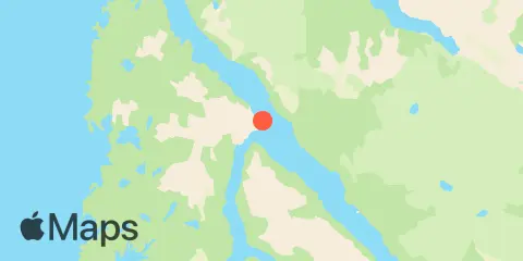
Location & Map
Latitude
58° 0' 36" N (58.01)
Longitude
136° 20' 31" W (-136.342)
State
County
Nearest ZIP
99832
Nearby
Tides
5.6 mi
Pelican Harbor, Lisianski Inlet
6.8 mi
Surge Bay, Yakobi Island, outer coast
8.6 mi
Takanis Bay, Yakobi Island, outer coast
11.7 mi
Canoe Cove, North Pass, Lisianski Strait and Inlet
Currents
0.5 mi
Lisianski Strait, north of Rock Point
10.7 mi
Yakobi Rock, 1 mile west of
11.3 mi
Cross Sound Entrance, NW of Cape Bingham
Note: Tide predictions are an estimate and NOT FOR NAVIGATION.
We also offer free widgets if you want to add tide or solunar tables to your own site.