Metlakatla Tides & Fishing Times
Tides
Metlakatla tide chart key:
The tide chart above shows the times and heights of high tide and low tide for Metlakatla, as well as solunar period times (represented by fish icons). The red line highlights the current time and estimated height.| Day | Time | Tide | Height | |
|---|---|---|---|---|
| 1 Sat | ▼ Low | 1.94 ft | ||
| 2 Sun | ▲ High | 14.08 ft | ||
| 2 Sun | ▼ Low | -0.36 ft | ||
| 2 Sun | ▲ High | 14.46 ft | ||
| 2 Sun | ▼ Low | 1.55 ft | ||
| 3 Mon | ▲ High | 13.46 ft |
Sunday, August 2, 2026 7:47 AM: The tide is currently falling at Metlakatla with a current estimated height of 2.8 ft. The last tide was High at 3:24 AM and the next tide is a Low of -0.36 ft at 9:41 AM. The tidal range today is approximately 14.82 ft with a minimum tide of -0.36 ft and maximum tide of 14.46 ft.
Next 7 Days
▲ Blue = High Tide
▼ Red = Low Tide
| Day | 1st Tide | 2nd Tide | 3rd Tide | 4th Tide | ☀ Sun |
Major Solunars
|
Minor Solunars
|
|
|---|---|---|---|---|---|---|---|---|
| 2 Sun |
|
▲ 14.08 ft |
▼ -0.36 ft |
▲ 14.46 ft |
▼ 1.55 ft |
▲ 4:57 AM ▼ 8:47 PM |
2:40 AM → 4:40 AM 2:52 PM → 4:52 PM |
9:29 AM → 10:29 AM 9:16 PM → 10:16 PM |
| 3 Mon |
|
▲ 13.46 ft |
▼ 0.43 ft |
▲ 14.64 ft |
▼ 1.26 ft |
▲ 4:59 AM ▼ 8:45 PM |
3:24 AM → 5:24 AM 3:37 PM → 5:37 PM |
10:51 AM → 11:51 AM 9:24 PM → 10:24 PM |
| 4 Tue |
|
▲ 12.62 ft |
▼ 1.42 ft |
▲ 14.68 ft |
▼ 1.11 ft |
▲ 5:00 AM ▼ 8:43 PM |
4:10 AM → 6:10 AM 4:24 PM → 6:24 PM |
12:15 PM → 1:15 PM 9:34 PM → 10:34 PM |
| 5 Wed |
|
▲ 11.61 ft |
▼ 2.54 ft |
▲ 14.54 ft |
▲ 5:02 AM ▼ 8:41 PM |
4:59 AM → 6:59 AM 5:16 PM → 7:16 PM |
1:44 PM → 2:44 PM 9:48 PM → 10:48 PM |
|
| 6 Thu |
|
▼ 1.04 ft |
▲ 10.62 ft |
▼ 3.7 ft |
▲ 14.31 ft |
▲ 5:04 AM ▼ 8:39 PM |
5:53 AM → 7:53 AM 6:12 PM → 8:12 PM |
3:14 PM → 4:14 PM 10:11 PM → 11:11 PM |
| 7 Fri |
|
▼ 0.87 ft |
▲ 10.07 ft |
▼ 4.65 ft |
▲ 14.18 ft |
▲ 5:06 AM ▼ 8:37 PM |
6:52 AM → 8:52 AM 7:22 PM → 9:22 PM |
4:42 PM → 5:42 PM 10:48 PM → 11:48 PM |
| 8 Sat |
|
▼ 0.37 ft |
▲ 10.33 ft |
▼ 5.03 ft |
▲ 14.44 ft |
▲ 5:08 AM ▼ 8:35 PM |
7:55 AM → 9:55 AM 8:30 PM → 10:30 PM |
6:10 PM → 7:10 PM |
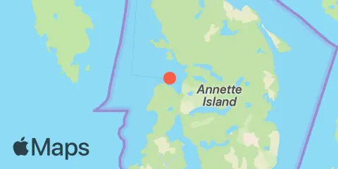
Location & Map
Latitude
55° 7' 42" N (55.1283)
Longitude
131° 34' 1" W (-131.567)
State
Nearest ZIP
99926
Nearby
Tides
4.4 mi
Tamgas Harbor, Annette Island
9.5 mi
Nehenta Bay, Gravina Island
Currents
2.5 mi
Wharburton Island
4.0 mi
Driest Point
5.3 mi
Point McCartey Light
7.6 mi
Grass Rock, Tamgas Harbor entrance
7.7 mi
Hid Reef, 2.7 miles south of
8.9 mi
Grass Rock, 1 mile south of
9.0 mi
Harris Island
9.3 mi
Blank Point
9.7 mi
Ajax Reef
10.1 mi
Point Davidson, 1 mile south of
10.5 mi
Walden Rocks, 0.4 mile north of
10.8 mi
Indian Reef
10.9 mi
Race Point, 0.7 mile ENE of
11.5 mi
Snipe Island
11.7 mi
Hotspur Island, 0.5 mile southeast of
12.0 mi
Customhouse Cove, 1 mile west of
12.1 mi
Pennock Island, West Channel
Note: Tide predictions are an estimate and NOT FOR NAVIGATION.
We also offer free widgets if you want to add tide or solunar tables to your own site.