Fire Island Tides & Fishing Times
Tides
Fire Island tide chart key:
The tide chart above shows the times and heights of high tide and low tide for Fire Island, as well as solunar period times (represented by fish icons). The red line highlights the current time and estimated height.| Day | Time | Tide | Height | |
|---|---|---|---|---|
| 1 Sat | ▲ High | 27.75 ft | ||
| 2 Sun | ▼ Low | 2.87 ft | ||
| 2 Sun | ▲ High | 26.66 ft | ||
| 2 Sun | ▼ Low | 1.05 ft | ||
| 2 Sun | ▲ High | 27.77 ft | ||
| 3 Mon | ▼ Low | 2.71 ft |
Sunday, August 2, 2026 8:46 AM: The tide is currently rising at Fire Island with a current estimated height of 23.7 ft. The last tide was Low at 4:26 AM and the next tide is a High of 26.66 ft at 10:00 AM. The tidal range today is approximately 26.72 ft with a minimum tide of 1.05 ft and maximum tide of 27.77 ft.
Next 7 Days
▲ Blue = High Tide
▼ Red = Low Tide
| Day | 1st Tide | 2nd Tide | 3rd Tide | 4th Tide | ☀ Sun |
Major Solunars
|
Minor Solunars
|
|
|---|---|---|---|---|---|---|---|---|
| 2 Sun |
|
▼ 2.87 ft |
▲ 26.66 ft |
▼ 1.05 ft |
▲ 27.77 ft |
▲ 5:37 AM ▼ 10:36 PM |
3:57 AM → 5:57 AM 4:06 PM → 6:06 PM |
10:50 AM → 11:50 AM 10:23 PM → 11:23 PM |
| 3 Mon |
|
▼ 2.71 ft |
▲ 25.88 ft |
▼ 2.9 ft |
▲ 27.53 ft |
▲ 5:39 AM ▼ 10:33 PM |
4:41 AM → 6:41 AM 4:51 PM → 6:51 PM |
12:22 PM → 1:22 PM 10:21 PM → 11:21 PM |
| 4 Tue |
|
▼ 2.78 ft |
▲ 24.79 ft |
▼ 5.02 ft |
▲ 27.04 ft |
▲ 5:42 AM ▼ 10:30 PM |
5:27 AM → 7:27 AM 5:38 PM → 7:38 PM |
1:58 PM → 2:58 PM 10:19 PM → 11:19 PM |
| 5 Wed |
|
▼ 2.99 ft |
▲ 23.5 ft |
▼ 7.15 ft |
▲ 5:44 AM ▼ 10:27 PM |
6:16 AM → 8:16 AM 6:36 PM → 8:36 PM |
3:39 PM → 4:39 PM 10:18 PM → 11:18 PM |
|
| 6 Thu |
|
▲ 26.35 ft |
▼ 3.1 ft |
▲ 22.28 ft |
▼ 8.86 ft |
▲ 5:47 AM ▼ 10:25 PM |
7:10 AM → 9:10 AM 7:35 PM → 9:35 PM |
5:50 PM → 6:50 PM 10:20 PM → 11:20 PM |
| 7 Fri |
|
▲ 25.62 ft |
▼ 2.8 ft |
▲ 21.57 ft |
▼ 9.64 ft |
▲ 5:50 AM ▼ 10:22 PM |
8:09 AM → 10:09 AM 8:39 PM → 10:39 PM |
7:46 PM → 8:46 PM 10:32 PM → 11:32 PM |
| 8 Sat |
|
▲ 25.14 ft |
▼ 1.88 ft |
▲ 21.82 ft |
▼ 9.29 ft |
▲ 5:52 AM ▼ 10:19 PM |
9:12 AM → 11:12 AM 9:50 PM → 11:50 PM |
9:10 PM → 10:10 PM |
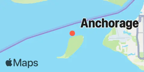
Location & Map
Nearby
Tides
11.6 mi
Point Possession
11.6 mi
Anchorage, Knik Arm, Cook Inlet
11.8 mi
Port Mackenzie, Cook Inlet
Currents
0.9 mi
Fire Island, 0.8nm north of
1.8 mi
Fire Island, 1.0nm north of
2.9 mi
Fire Island, 1.0nm east of
5.1 mi
Point Woronzof, southwest of
5.1 mi
Fire Island, 1.2nm south of
5.6 mi
Point Woronzof, west of
8.2 mi
Point Woronzof, 1.2nm NE of
9.5 mi
Point Possession, northeast of
9.6 mi
Anchorage, west of
10.0 mi
Fire Island, west of
10.5 mi
Point Possession, northwest of
10.8 mi
Anchorage, 0.2 mile offshore
11.2 mi
Port Mackenzie, south of
11.3 mi
Anchorage Shipdock, northwest of
11.8 mi
Fire Island Shoal, northwest of
11.8 mi
Port Mackenzie
11.9 mi
Point Possession, WNW of
12.3 mi
Cairn Point, northwest of (east side)
Note: Tide predictions are an estimate and NOT FOR NAVIGATION.
We also offer free widgets if you want to add tide or solunar tables to your own site.