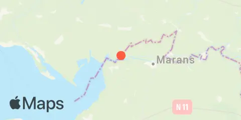
Pont-du-Brault Weekly Tide Tables and Charts
Tide Chart for Next 7 Days
About this chart
Pont-du-Brault weekly tide chart key:
The tide chart above shows the times and heights of high tide and low tide for Pont-du-Brault, for the next seven days. The red line highlights the current time and estimated height.The tidal range at Pont-du-Brault from through is approximately 4.81 m, with a minimum tide of 0.53 m and maximum tide of 5.34 m. You can also check out all the daily details on tides & fishing times on the Day tab for Pont-du-Brault.
Tide Table for Next 7 Days
| Day | Moon phase | 1st Tide | 2nd Tide | 3rd Tide | 4th Tide | ☀ Sun |
Major Times

|
Minor Times

|
|---|---|---|---|---|---|---|---|---|
 96% |
▲ 4.89 m |
▼ 1.28 m |
▲ 5.1 m |
▼ 1.06 m |
▲ 8:33 AM ▼ 7:02 PM |
11:17 AM → 1:17 PM |
5:55 AM → 6:55 AM 5:26 PM → 6:26 PM |
|
|
99%
|
▲ 5.15 m |
▼ 1.03 m |
▲ 5.29 m |
▼ 0.86 m |
▲ 7:35 AM ▼ 6:00 PM |
11:41 PM → 1:41 AM 11:06 AM → 1:06 PM |
6:12 AM → 7:12 AM 4:47 PM → 5:47 PM |
|
 100% |
▲ 5.29 m |
▼ 0.8 m |
▲ 5.34 m |
▼ 0.71 m |
▲ 7:36 AM ▼ 5:59 PM |
11:31 PM → 1:31 AM 11:58 AM → 1:58 PM |
7:33 AM → 8:33 AM 5:13 PM → 6:13 PM |
|
 98% |
▲ 5.32 m |
▼ 0.63 m |
▲ 5.28 m |
▲ 7:38 AM ▼ 5:57 PM |
12:26 AM → 2:26 AM 12:55 PM → 2:55 PM |
8:56 AM → 9:56 AM 5:46 PM → 6:46 PM |
||
|
93%
|
▼ 0.64 m |
▲ 5.24 m |
▼ 0.53 m |
▲ 5.1 m |
▲ 7:39 AM ▼ 5:55 PM |
1:26 AM → 3:26 AM 1:57 PM → 3:57 PM |
10:19 AM → 11:19 AM 6:31 PM → 7:31 PM |
|
|
85%
|
▼ 0.66 m |
▲ 5.09 m |
▼ 0.54 m |
▲ 4.84 m |
▲ 7:41 AM ▼ 5:54 PM |
2:29 AM → 4:29 AM 3:02 PM → 5:02 PM |
11:34 AM → 12:34 PM 7:29 PM → 8:29 PM |
|
|
76%
|
▼ 0.76 m |
▲ 4.88 m |
▼ 0.66 m |
▲ 4.53 m |
▲ 7:42 AM ▼ 5:52 PM |
3:34 AM → 5:34 AM 4:06 PM → 6:06 PM |
12:35 PM → 1:35 PM 8:41 PM → 9:41 PM |
About these predictions
Tide heights are predictions, not measurements. Wind, air pressure, storms, and river flow can cause actual water levels to differ. Not for navigation.
Tide prediction source:
Slackwater database (https://github.com/openwatersio/slackwater-database). Source: Hart-Davis, M., Dettmering, D., Seitz, F. (2025), TICON-4: TIdal CONstants based on GESLA-4 sea-level records, SEANOE, https://doi.org/10.17882/109129. Licensed CC BY 4.0 ( license details
). Modified: see https://github.com/openwatersio/slackwater-database#modifications-to-source-data Predictions generated with Slackwater; not an official government forecast. Official source
Vertical datum:
LAT — LAT
Add a free tide or fishing times widget for this station to your website.