Benner Bay Tides
Unfortunately, this tide station is no longer active, and predictions are no longer accurate.
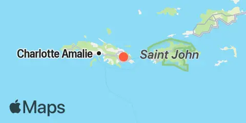
You can check out the map below -- any nearby locations will be displayed on the map and list below. Alternatively, you can browse the site for other active locations.
Location & Map
Latitude
18° 19' 12" N (18.32)
Longitude
64° 52' 12" W (-64.87)
State
County
Nearest ZIP
00802
Nearby
Tides
0.7 mi
Jersey Bay, St. Thomas
1.3 mi
Redhook Bay, St. Thomas
1.8 mi
Pavilion Point, St. Thomas
2.0 mi
Water Bay, St. Thomas
3.7 mi
Charlotte Amalie, St. Thomas
3.8 mi
Dog Island, St. Thomas
4.7 mi
Magens Bay, St. Thomas
5.1 mi
Cruz Bay, St. John
5.2 mi
Lovango Cay, St. John
5.4 mi
Crown Bay, St. Thomas
6.4 mi
Hawksnest Beach, St. John
7.1 mi
Dorothea Bay, St. Thomas
7.1 mi
Fish Bay, St. John
9.6 mi
Lameshur Bay, St. John
10.3 mi
Coral Harbor, St. John
10.3 mi
Leinster Point, Leinster Bay, St. John
11.0 mi
Johns Folly Bay, St. John
11.2 mi
Botany Bay, St. Thomas