Harbor Of Refuge Tides
Unfortunately, this tide station is no longer active, and predictions are no longer accurate.
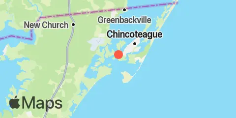
You can check out the map below -- any nearby locations will be displayed on the map and list below. Alternatively, you can browse the site for other active locations.
Location & Map
Latitude
37° 54' 12" N (37.9033)
Longitude
75° 24' 24" W (-75.4067)
State
County
Nearest ZIP
23336
Nearby
Tides
0.1 mi
Southern Chincoteague Island, Chincoteague Bay
0.3 mi
Chincoteague Channel (South End), Chincoteague Bay
2.3 mi
Chincoteague Island, USCG station
3.0 mi
Chincoteague Island, Lewis Creek
3.4 mi
Assateague Beach, Toms Cove
4.2 mi
Chincoteague Island, Oyster Bay
4.4 mi
Chincoteague Island, Blake Cove
4.9 mi
Wishart Point, Bogues Bay
5.8 mi
Wallops Island
7.3 mi
Franklin City
7.9 mi
Jesters Island
12.2 mi
Gargathy Neck