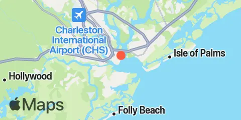
Charleston Tablas y gráficos semanales de mareas
Gráfico de mareas para los próximos 7 días
Leyenda del gráfico semanal de mareas de Charleston:
El gráfico muestra las horas y alturas de pleamar y bajamar en Charleston durante los próximos siete días. La línea roja indica la hora actual y la altura estimada.El rango de mareas en Charleston durante los próximos siete días es de aproximadamente 6.28 ft, con una altura mínima de 0.28 ft y una máxima de 6.56 ft. También puedes consultar todas las mareas y horas de pesca de Charleston en la pestaña Día.
Tabla de mareas para los próximos 7 días
▲ Azul = Pleamar
▼ Rojo = Bajamar
| Día | Fase lunar | 1st Marea | 2nd Marea | 3rd Marea | 4th Marea | ☀ Sol |
Solunares mayores

|
Solunares menores

|
|---|---|---|---|---|---|---|---|---|
| 8 jue |
 8%
8%
|
▼ 0.49 ft |
▲ 6.2 ft |
▼ 0.32 ft |
▲ 6.28 ft |
▲ 07:19 ▼ 18:55 | 10:33 → 12:33 |
04:43 → 05:43 17:15 → 18:15 |
| 9 vie |
3%
|
▼ 0.34 ft |
▲ 6.43 ft |
▼ 0.28 ft |
▲ 6.18 ft |
▲ 07:19 ▼ 18:54 |
23:00 → 01:00 11:17 → 13:17 |
05:45 → 06:45 17:43 → 18:43 |
| 10 sáb |
 0%
0%
|
▼ 0.28 ft |
▲ 6.55 ft |
▼ 0.33 ft |
▲ 6.02 ft |
▲ 07:20 ▼ 18:53 |
23:44 → 01:44 12:02 → 14:02 |
06:46 → 07:46 18:11 → 19:11 |
| 11 dom |
 1%
1%
|
▼ 0.33 ft |
▲ 6.56 ft |
▼ 0.46 ft |
▲ 5.81 ft |
▲ 07:21 ▼ 18:51 |
00:29 → 02:29 12:48 → 14:48 |
07:47 → 08:47 18:42 → 19:42 |
| 12 lun |
2%
|
▼ 0.46 ft |
▲ 6.46 ft |
▼ 0.66 ft |
▲ 5.58 ft |
▲ 07:22 ▼ 18:50 |
01:15 → 03:15 13:34 → 15:34 |
08:49 → 09:49 19:16 → 20:16 |
| 13 mar |
6%
|
▼ 0.66 ft |
▲ 6.28 ft |
▼ 0.91 ft |
▲ 5.35 ft |
▲ 07:22 ▼ 18:49 |
02:02 → 04:02 14:23 → 16:23 |
09:49 → 10:49 19:54 → 20:54 |
| 14 mié |
11%
|
▼ 0.88 ft |
▲ 6.07 ft |
▼ 1.18 ft |
▲ 5.13 ft |
▲ 07:23 ▼ 18:48 |
02:51 → 04:51 15:14 → 17:14 |
10:49 → 11:49 20:37 → 21:37 |
Ubicación y mapa
Latitud
32° 46' 51" N (32.7808)
Longitud
79° 55' 25" W (-79.9236)
Estado
Condado
Código postal cercano
29401
Cerca
Mareas
1.9 mi
South Ashley Bridge, Ashley River
2.5 mi
Fort Johnson
2.6 mi
Shem Creek
2.9 mi
James Island Creek, 1 mi. above ent., Ashley River
3.0 mi
Wappoo Creek, highway bridge, Ashley River
3.1 mi
Hobcaw Point, Wando River
3.3 mi
Fort Sumter
3.9 mi
Shipyard Creek, 0.8 mile above entrance.
4.1 mi
The Cove, Fort Moultrie
4.2 mi
Duck Island, Ashley River
4.7 mi
Elliott Cut entrance, Stono River
4.8 mi
Ben Sawyer Bridge, ICWW
5.2 mi
Cosgrove Bridge, Ashley River
5.3 mi
Sullivans Island (outer coast)
5.5 mi
Clouter Creek, south entrance, Cooper River
6.5 mi
Breach Inlet, Isle of Palms
6.9 mi
I-526 bridge, Ashley River
7.5 mi
Folly Creek, Hwy. 171 bridge
7.7 mi
Folly River, north, Folly Island
7.7 mi
Hamlin Creek, Isle of Palms
8.1 mi
Isle of Palms Pier
8.2 mi
Sandblasters, Pennys Creek, Stono River
8.3 mi
Folly River Bridge, Folly Island
8.4 mi
Nowell Creek, Wando River
8.5 mi
Parker Island, Horlbeck Creek, Wando River
8.6 mi
Pennys Creek, west entrance, Stono River
8.6 mi
Hamlin Sound
8.7 mi
Abbapoola Creek entrance, Stono River
8.7 mi
Clouter Creek, north entrance, Cooper River
8.8 mi
Drayton, Bee's Ferry, Ashley River
9.1 mi
Folly Island (outer coast)
9.1 mi
Army Depot, Cooper River
10.6 mi
Limehouse Bridge, Stono River
10.6 mi
Yeamans Hall, Goose Creek, Cooper River
10.8 mi
Church Creek bridge, Wadmalaw River
10.8 mi
Hanahan, Turkey Creek, Goose Creek, Cooper River
11.1 mi
Snake Island, Stono River
11.4 mi
Magnolia Gardens, Ashley River
11.5 mi
Cainhoy, Wando River
11.6 mi
Snow Point, 0.4 mi. North of, Cooper River
12.0 mi
South Dewees Island, Dewees Inlet
12.1 mi
Oak Branch, Bohicket Creek, North Edisto River
Corrientes
0.1 mi
Customhouse Reach, off Customhouse
0.2 mi
Customhouse Reach
0.4 mi
Shutes Folly Island, 0.4 mile west of
0.6 mi
Horse Reach
0.8 mi
Bennis Range, Buoy 34
0.8 mi
Lower Town Creek Reach
1.0 mi
Drum Island, 0.4 mile SSE of
1.0 mi
Castle Pinckney, 0.6 mile southwest of
1.1 mi
Hog Island Reach, Buoy 38
1.1 mi
Battery, southwest of
1.2 mi
Castle Pinckney, 0.4 mile south of
1.5 mi
Bennis Range, Buoy 31
1.5 mi
South Channel, Buoy 4
1.5 mi
Folly I. Channel, N of Ft. Johnson
1.6 mi
Wappoo Creek entrance
1.7 mi
Drum Island, east of (bridge)
1.8 mi
Town Creek, 0.2 mile above bridge
1.9 mi
South Chan., 0.4 mi. NW of Ft. Johnson
2.1 mi
Ashley River Memorial Bridge, Highway 17
2.2 mi
Hog Island Reach, SW of Remley Point
2.4 mi
Drum Island Reach, marker 45
2.6 mi
Remley Point, 0.2 mile northwest of
2.7 mi
Drum Island, 0.2 mile above
2.7 mi
South Chan., 0.8 mi. ENE of Ft. Johnson
2.7 mi
Hog Island Channel
3.1 mi
Trestle Ruins, marker 6A
3.1 mi
Rebellion Reach, 0.8 n.mi. N. of Ft. Sumter
3.1 mi
The Cove, entrance on the Cove Range
3.2 mi
Daniel Island Reach, Buoy 48
3.5 mi
Shipyard Creek entrance
3.5 mi
Charleston Harbor (off Fort Sumter)
3.6 mi
Ft. Sumter, 0.6 n.mi. NW of
3.6 mi
Daniel Island Reach, Buoy 47A
3.6 mi
Duck Island, Marker 15
4.0 mi
Wando River Upper Reach, Turning Basin
4.5 mi
Elliott Cut, west end
4.7 mi
Daniel Island Bend
5.2 mi
State Hwy. 7 bridge
5.4 mi
Johns Island Bridge
5.4 mi
Fort Sumter Range, Buoy 22
5.5 mi
South Jetty, break in
5.7 mi
Rathall Creek entrance
5.9 mi
West Marsh Island, 0.1 mile east of
6.1 mi
North Charleston
6.2 mi
Charleston Hbr. ent. (between jetties)
7.2 mi
Nowell Creek, Southeast of
7.3 mi
Nowell Creek entrance
7.7 mi
Fort Sumter Range, Buoy 18
7.7 mi
Filbin Creek Reach, 0.2 mile east of
7.8 mi
Filbin Creek Reach
8.2 mi
Johns Island Airport, south of
8.3 mi
Filbin Creek Reach, Buoy 58
8.4 mi
North Jetty, 0.8 mile southeast of
8.5 mi
Horlbeck Creek, 0.2 mile above entrance
8.6 mi
Drayton, Railroad Bridge
8.8 mi
Ordnance Reach
8.9 mi
Yellow House Creek
8.9 mi
Fort Sumter Range, Buoy 16
9.6 mi
Yellow House Landing, 1 mile NW of
10.0 mi
Woods Point, SE of
10.5 mi
Woods Point
10.7 mi
Johns Island. Main Road Bridge
10.7 mi
Anneville, marker 36
11.2 mi
Snake Island
11.3 mi
Fort Sumter Range, Buoy 14
11.4 mi
Stono Inlet
11.8 mi
Snow Point, 0.5 mile north of
12.3 mi
off Amoco Pier
12.4 mi
Pleasant Point
Fuente de las predicciones de mareas:
NOAA
Referencia vertical:
MLLW — Mean Lower Low Water
Nota: Las predicciones de mareas son estimaciones y NO DEBEN USARSE PARA NAVEGAR.
Widgets gratuitos también están disponibles para añadir tablas de mareas o solunares a tu sitio.