TidesPro TidesPro
  • Récents
    • Long Key, 0.5mi N. of Corey Causeway, Boca Ciega Bay
  • Marées
    États-Unis
    Alabama Alaska California Connecticut Delaware District of Columbia Florida Georgia Hawaii
    Louisiana Maine Maryland Massachusetts Mississippi New Hampshire New Jersey New York North Carolina
    Oregon Pennsylvania Rhode Island South Carolina Texas US Outlying Islands Virginia Washington Puerto Rico
    Caraïbes
    Bahamas Îles Caïmans Cuba République dominicaine Haïti Jamaïque Îles Vierges américaines
  • Coordonnées de pêche Pêche
    Alabama - Alabama Inshore Public Reefs Alabama - Alabama Nearshore Public Reefs Alabama - Alabama Offshore Public Reefs California - California Artificial Reefs Delaware - Delaware Artificial Reefs Florida - Bay County Florida - Brevard County Florida - Broward County Florida - Charlote and Lee Counties Florida - Citrus County Florida - Collier County Florida - Dixie County Florida - Duval County Florida - Escambia County Florida - Flagler County Florida - Florida Keys Florida - Franklin County Florida - Gulf County Florida - Hernando County
    Florida - Indian River County Florida - Levy County Florida - Manatee County Florida - Martin County Florida - Miami-Dade County Florida - Monroe County Florida - Nassau County Florida - Okaloosa County Florida - Palm Beach County Florida - Pasco County Florida - Santa Rosa County Florida - Sarasota County Florida - St. Johns County Florida - St. Lucie County Florida - Tampa Bay Florida - Taylor County Florida - Volusia County Florida - Wakulla County Florida - Walton County
    Georgia - Georgia Reefs Hawaii - Hawaii Artificial Reefs Louisiana - Louisiana Artificial Reefs Maryland - Maryland Artificial Reefs Massachusetts - Massachusetts Artificial Reefs Mississippi - Mississippi Inshore Artificial Reefs Mississippi - Mississippi Offshore Artificial Reefs New Jersey - New Jersey Artificial Reefs New York - New York Artificial Reefs North Carolina - Estuarine North Carolina - Long Bay North Carolina - Onslow Bay North Carolina - Outer Banks North Carolina - Raleigh Bay Puerto Rico - Puerto Rico Artificial Reefs Rhode Island - Rhode Island Artificial Reefs South Carolina - South Carolina Reefs Texas - Texas Artificial Reefs Virginia - Virginia Artificial Reefs
  • Tables solunaires
    • Langue
    • English
    • Español
    • Français

    • Unités

    • Lieux récents
    • Mémoriser les lieux récents sur cet appareil
      Conserve vos cinq dernières stations pendant 30 jours. La désactivation efface l’historique enregistré.

¿Ver TidesPro en español? Voir TidesPro en français ? View TidesPro in English?
Station Long Key
  1. États-Unis
  2. Florida
  3. Long Key, 0.5mi N. of Corey Causeway, Boca Ciega Bay

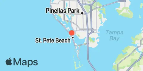
Long Key Carte

Jour Semaine Table mensuelle Graphique mensuel Carte
Latitude
27° 45' 6" N (27.7517)
Longitude
82° 45' 12" W (-82.7533)
État
Florida
Comté
Pinellas County
Code postal le plus proche
33706
À proximité
Marées 2.9 mi Johns Pass, Boca Ciega Bay 3.0 mi Gulfport, Boca Ciega Bay 4.7 mi Madeira Beach Causeway, Boca Ciega Bay 4.9 mi Pass-a-Grille Beach, Boca Ciega Bay 7.7 mi Point Pinellas 7.8 mi St. Petersburg, Tampa Bay 9.6 mi Mullet Key Channel (Skyway), Tampa Bay 10.4 mi Egmont Key, Egmont Channel, Tampa Bay 10.5 mi Indian Rocks Beach (Inside) Courants 0.6 mi Blind Pass (north end) 2.8 mi Johns Pass Entrance 2.8 mi Johns Pass Bridge, north span 2.8 mi Johns Pass Bridge, 0.3nm north of 3.5 mi Cats Point (bridge west of) 4.7 mi Pine Key (Pinellas Bayway bridge) 4.7 mi Pass-a-Grille Channel 6.0 mi Bridge, 0.8 mi. south of Maximo Pt. 7.3 mi Bunces Pass (West of Bayway bridge) 8.3 mi Pinellas Point, 0.5 mile southeast of 9.0 mi Lewis Island, 0.9 mile east of 9.3 mi Pinellas Point, 2.6 miles south of 9.9 mi Pinellas Point, 1.9 miles SE of 10.2 mi Tampa Bay Entrance (Egmont Channel) 10.3 mi Mullet Key Channel entrance 10.5 mi The Narrows (Indian Rocks Beach Bridge) 10.6 mi Mullet Key Channel, marker '24' 10.7 mi Egmont Channel (3 mi. W of Egmont Key Lt.) 10.9 mi Sunshine Skyway Bridge 11.1 mi Cut A & B, Channel Junction 11.2 mi Port Manatee Channel Entrance 11.5 mi Snell Isle, 1.8 miles east of 12.1 mi Port Manatee Channel, marker '4'

À propos

TidesPro propose des prévisions de marées, des données solunaires et la météo marine pour pêcher, aller à la plage, naviguer, faire du kayak ou du surf, et préparer un voyage. Il permet aussi de trouver des lieux de pêche et les meilleurs moments pour y pêcher.

Disponible sur le Web, iPhone, iPad, Apple Watch et Mac.

En savoir plus →

Application

Apple App Store
  • En savoir plus →
  • TidesPro pour Mac →

Liens rapides

  • Quand pêcher
  • Théorie solunaire
  • Widgets de marées et données solunaires pour votre site
  • Prévisions de marées et données solunaires dans Google Earth
  • Activités
  • À propos

© Copyright 2017 - 2026 ASR Concepts LLC. Tous droits réservés.

  • Politique de confidentialité
  • •
  • Conditions d’utilisation
  • •
  • Contact
  • •
  • Bluesky
  • •
  • Mastodon