Quonset Point Tables et graphiques hebdomadaires des marées
Graphique des marées des 7 prochains jours
Légende du graphique hebdomadaire des marées de Quonset Point :
Le graphique indique les horaires et hauteurs des pleines et basses mers à Quonset Point pour les sept prochains jours. La ligne rouge indique l’heure actuelle et la hauteur estimée.Le marnage à Quonset Point pour les sept prochains jours est d’environ 4.81 ft, avec une hauteur minimale de -0.02 ft et une maximale de 4.79 ft. Vous pouvez aussi consulter les marées et horaires de pêche de Quonset Point dans l’onglet Jour.
Table des marées des 7 prochains jours
▲ Bleu = Pleine mer
▼ Rouge = Basse mer
| Jour | Phase lunaire | 1st Marée | 2nd Marée | 3rd Marée | 4th Marée | ☀ Soleil |
Solunaires majeures

|
Solunaires mineures

|
|---|---|---|---|---|---|---|---|---|
| 8 jeu. |
 8%
8%
|
▼ 0.16 ft |
▲ 4.47 ft |
▼ 0.15 ft |
▲ 4.27 ft |
▲ 06:50 ▼ 18:16 |
09:58 → 11:58 22:26 → 00:26 |
04:03 → 05:03 16:40 → 17:40 |
| 9 ven. |
3%
|
▼ 0.06 ft |
▲ 4.69 ft |
▼ 0.05 ft |
▲ 4.26 ft |
▲ 06:51 ▼ 18:14 | 10:42 → 12:42 |
05:12 → 06:12 17:02 → 18:02 |
| 10 sam. |
 0%
0%
|
▼ 0 ft |
▲ 4.79 ft |
▼ 0 ft |
▲ 4.16 ft |
▲ 06:52 ▼ 18:12 |
23:11 → 01:11 11:27 → 13:27 |
06:20 → 07:20 17:24 → 18:24 |
| 11 dim. |
 1%
1%
|
▼ -0.02 ft |
▲ 4.75 ft |
▼ 0.02 ft |
▲ 3.99 ft |
▲ 06:53 ▼ 18:11 |
23:55 → 01:55 12:12 → 14:12 |
07:27 → 08:27 17:49 → 18:49 |
| 12 lun. |
2%
|
▼ 0.02 ft |
▲ 4.58 ft |
▼ 0.09 ft |
▲ 3.76 ft |
▲ 06:54 ▼ 18:09 |
00:42 → 02:42 12:59 → 14:59 |
08:35 → 09:35 18:17 → 19:17 |
| 13 mar. |
6%
|
▼ 0.11 ft |
▲ 4.32 ft |
▼ 0.23 ft |
▲ 3.52 ft |
▲ 06:56 ▼ 18:08 |
01:29 → 03:29 13:48 → 15:48 |
09:41 → 10:41 18:51 → 19:51 |
| 14 mer. |
11%
|
▼ 0.25 ft |
▲ 4 ft |
▼ 0.42 ft |
▲ 3.28 ft |
▲ 06:57 ▼ 18:06 |
02:17 → 04:17 14:39 → 16:39 |
10:44 → 11:44 19:30 → 20:30 |
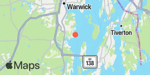
Localisation et carte
Latitude
41° 35' 12" N (41.5868)
Longitude
71° 24' 40" W (-71.411)
État
Comté
Code postal le plus proche
02852
À proximité
Marées
2.0 mi
Wickford, Narragansett Bay
2.2 mi
Conanicut Point, Conanicut Island
4.6 mi
Prudence Island, (South End), Narragansett Bay
5.7 mi
East Greenwich, Narragansett Bay
6.4 mi
West Jamestown, Dutch Island Harbor, Conanicut Island
7.1 mi
Newport, Narragansett Bay
8.8 mi
Bristol Ferry, Narragansett Bay
8.8 mi
Bristol, Bristol Harbor, Narragansett Bay
8.8 mi
Watson Pier, Boston Neck, Narragansett Bay
8.9 mi
Castle Hill, Narragansett Bay
9.2 mi
The Glen, Sakonnet River
9.4 mi
Beavertail Point, Conanicut Island
9.6 mi
Conimicut Light, Narragansett Bay
9.7 mi
Bristol Highlands, Narragansett Bay
10.9 mi
Anthony Point, Sakonnet River
11.0 mi
Nannaquaket Neck, Sakonnet River
11.3 mi
Sachuest, Flint Point, Sakonnet River
11.3 mi
North End, Bay Oil pier, Sakonnet River
11.6 mi
Narragansett Pier, Narragansett Bay
11.8 mi
Bay Spring, Bullock Cove, Narragansett Bay
12.1 mi
Kickamuit River, Narragansett Bay
12.2 mi
Pawtuxet, Pawtuxet Cove, Narragansett Bay
Courants
0.8 mi
Quonset Point
3.7 mi
Conanicut Point, ENE of
4.7 mi
Gould Island, west of
5.3 mi
Dyer Island, west of
5.6 mi
Patience I. and Warwick Neck, between
5.7 mi
Dutch Island, west of
5.7 mi
Gould Island, southeast of
5.8 mi
Patience Island, narrows east of
6.0 mi
Dyer Island-Carrs Point (between)
6.2 mi
Dutch Island and Beaver Head, between
6.3 mi
Rose Island, northwest of
7.0 mi
Rose Island, west of
7.1 mi
Rose Island, northeast of
7.3 mi
Hog Island, northwest of
8.0 mi
Bull Point, east of
8.7 mi
Mount Hope Bridge
8.9 mi
Beavertail Point, 0.8 mile northwest of
9.2 mi
Castle Hill, west of, East Passage
9.6 mi
Common Fence Point, west of
10.1 mi
Nayatt Point, WNW of
10.2 mi
Almy Point Bridge, south of, Sakonnet River
10.9 mi
Brenton Point, 1.4 n.mi. southwest of
11.3 mi
Black Point, SW of, Sakonnet River
11.7 mi
Warren, Warren River
12.2 mi
Mount Hope Point, northeast of
Source des prévisions de marées :
NOAA
Référence verticale :
MLLW — Mean Lower Low Water
Remarque : Les prévisions de marées sont des estimations et NE DOIVENT PAS SERVIR À LA NAVIGATION.
Widgets gratuits sont également disponibles pour ajouter des tables de marées ou solunaires à votre site.