Summerland Key, southwest side, Kemp Channel 釣りの時間
Summerland Keyの釣りに役立つ潮汐、ソルナー理論に基づく主要・副次活動時間帯、7日間の釣り予測を確認できます。
主要ソルナー時間帯
11:03
13:03
干潮 · 15:42 · -0.04 ft
ソルナー時刻に基づいています。天候や水の状態も考慮してください。
潮汐と釣り時間帯
潮汐の詳細 →網掛けの帯は主要な釣り時間帯を示します。魚のマークはすべての主要・副時間帯を示します。
釣りの時間
主要な釣り時間
11:03 13:03
副次的な釣り時間
05:38 06:38
17:35 18:35
ソルナー理論について →潮汐時刻と潮位
| 潮汐 | 時刻 | 高さ |
|---|---|---|
| 干潮 | -0.07′ | |
| 満潮 | 1.02′ | |
| 干潮 | -0.04′ | |
| 満潮 | 1.39′ |
天気と海況
2027年3月20日土曜日
選択した期間の予報はありません。
気圧
この日付の気圧予報は現在利用できません。
太陽と月
月相
 満月に向かう凸月
照明率 96%
太陽と月
- 日の出
- 日の入り
- 月の入り
- 月の出
7日間の釣りプランナー
毎日の評価、すべての主要・副ソルナー時間帯、潮汐時刻と潮位。
釣り評価について
この評価は、ソルナー条件に基づく魚の活動の可能性を大まかに示すものです。天候、水の状態、魚種、地域の釣果情報は含まれません。評価が高くても釣果を保証するものではありません。
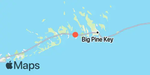
ソルナー理論について場所と地図
周辺
潮汐
0.7 mi
Summerland Key, Niles Channel South
0.9 mi
Summerland Key, Niles Channel Bridge
1.6 mi
Kemp Channel Viaduct, Florida Keys
1.6 mi
Ramrod Key, Niles Channel Bridge
2.5 mi
Gopher Key, Cudjoe Bay
2.7 mi
Ramrod Key, Newfound Harbor
2.9 mi
Cudjoe Key, Cudjoe Bay
2.9 mi
Middle Torch Key, Torch Ramrod Channel
3.3 mi
Munson Island, Newfound Harbor Channel
3.3 mi
Key Lois, southeast end
3.4 mi
Little Torch Key, Torch Channel
3.9 mi
Big Torch Key, Niles Channel
3.9 mi
Little Torch Key, Pine Channel Bridge, South Side
4.3 mi
Sugarloaf Key, East Side, Tarpon Creek
4.3 mi
Sugarloaf Key, Pirates Cove
4.4 mi
Cudjoe Key, Pirates Cove
4.5 mi
Big Pine Key, Newfound Harbor Channel
4.6 mi
Tarpon Creek, Upper Sugarloaf Sound
4.9 mi
Big Pine Key, West Side, Pine Channel
4.9 mi
Big Pine Key, Pine Channel Bridge, South Side
4.9 mi
Knockemdown Key, North End
5.0 mi
Cudjoe Key, North End, Kemp Channel
5.1 mi
Big Pine Key, Pine Channel Bridge, North Side
5.6 mi
Sugarloaf Key, Northeast Side, Bow Channel
5.8 mi
Howe Key, South End, Harbor Channel
5.9 mi
Park Channel Bridge, Upper Sugarloaf Sound
6.0 mi
Big Torch Key, Harbor Channel
6.1 mi
Big Pine Key, Coupon Bight
6.3 mi
Big Pine Key, Doctors Arm, Bogie Channel
6.6 mi
Big Pine Key, Northeast Shore
6.7 mi
Water Keys, South End, Harbor Channel
6.7 mi
North Harris Channel, Upper Sugarloaf Sound
6.7 mi
Raccoon Key, East Side
7.0 mi
Big Pine Key, Bogie Channel Bridge
7.3 mi
Big Pine Key, North End
7.3 mi
Big Pine Key, Spanish Harbor
7.4 mi
Sugarloaf Key, North End, Bow Channel
7.6 mi
Howe Key, northwest end
7.6 mi
Porpoise Key, Big Spanish Channel
7.8 mi
Perky, Upper Sugarloaf Sound
7.9 mi
Mayo Key, Big Spanish Channel
8.3 mi
Annette Key, North End, Big Spanish Channel
8.6 mi
Pumpkin Key, Bow Channel
8.7 mi
No Name Key, East Side, Bahia Honda Channel
9.1 mi
Water Key, west end, Big Spanish Channel
9.2 mi
Crawl Key, Big Spanish Channel
9.8 mi
Big Spanish Key
9.8 mi
Little Spanish Key, Spanish Banks
10.0 mi
Content Keys, Content Passage
10.0 mi
Saddlebunch Keys, Channel No. 3
10.0 mi
Little Pine Key, South End
10.1 mi
Johnston Key, southwest end, Turkey Basin
10.2 mi
Little Pine Key, North End
10.2 mi
Snipe Keys, Southeast End, Inner Narrows
10.4 mi
Bahia Honda Key, Bahia Honda Channel
10.4 mi
Sawyer Key, Inside, Cudjoe Channel
11.0 mi
Saddlebunch Keys, Channel No. 4
11.2 mi
Johnson Keys, North End
11.3 mi
Johnson Keys, South End
11.4 mi
Saddlebunch Keys, Channel No. 5
11.5 mi
Saddlebunch Keys, Similar Sound
11.6 mi
Snipe Keys, Middle Narrows
12.3 mi
Ohio Key-Bahia Honda Key Channel, west side
この潮汐予測について
潮位は予測値であり、実測値ではありません。風、気圧、嵐、河川流量によって実際の水位が異なることがあります。航海用ではありません。
潮汐予測の出典:
Tide predictions: NOAA Center for Operational Oceanographic Products and Services (CO-OPS). 公式情報源
高さの基準面:
MLLW — Mean Lower Low Water