Wappoo Creek Maree
Grafico delle maree
Informazioni su questo grafico
 Elevata attività dei pesci
 Attività dei pesci molto elevata
Legenda del grafico delle maree di Wappoo Creek:
Il grafico sopra mostra gli orari e le altezze di alta e bassa marea per Wappoo Creek, insieme agli orari dei periodi solunari (rappresentati da icone di pesci). La linea rossa indica l'ora attuale e l'altezza stimata.Due pesci indicano i periodi solunari minori (elevata attività dei pesci); quattro pesci indicano i periodi solunari maggiori (attività dei pesci molto elevata).
Orari e altezze delle maree
| Marea | Ora | Altezza |
|---|---|---|
| Bassa marea | -0.07′ | |
| Alta marea | 6.00′ | |
| Bassa marea | 0.27′ |
Escursione di marea per il : 6.07 ft (minimo -0.07 ft, massimo 6 ft).
Escursione di marea per il : 6.07 ft (minimo -0.07 ft, massimo 6 ft).
Orari locali Altezze in ft rispetto a MLLW
Previsioni meteo e marine
domenica 29 novembre 2026
Previsioni non disponibili per questa selezione.
| Data | dom, nov 22 | lun, nov 23 | mar, nov 24 | mer, nov 25 | gio, nov 26 | ven, nov 27 | sab, nov 28 | |||||||||||||||||||||||||||||||||||||||||||||||||||||||||
|---|---|---|---|---|---|---|---|---|---|---|---|---|---|---|---|---|---|---|---|---|---|---|---|---|---|---|---|---|---|---|---|---|---|---|---|---|---|---|---|---|---|---|---|---|---|---|---|---|---|---|---|---|---|---|---|---|---|---|---|---|---|---|---|---|
| Previsioni | ||||||||||||||||||||||||||||||||||||||||||||||||||||||||||||||||
| Meteo °F Precipitazioni |
65°
13%
|
65°
9%
|
64°
5%
|
64°
3%
|
62°
2%
|
61°
2%
|
61°
2%
|
60°
1%
|
59°
1%
|
59°
1%
|
58°
1%
|
57°
1%
|
57°
1%
|
56°
1%
|
58°
1%
|
63°
1%
|
66°
1%
|
68°
1%
|
69°
1%
|
70°
1%
|
71°
|
72°
|
70°
|
67°
|
65°
|
65°
|
64°
|
63°
|
62°
|
64°
|
64°
1%
|
62°
1%
|
60°
2%
|
63°
2%
|
61°
3%
|
59°
3%
|
57°
7%
|
51°
37%
|
47°
37%
|
49°
62%
|
51°
62%
|
53°
66%
|
55°
66%
|
58°
52%
|
56°
18%
|
54°
18%
|
56°
5%
|
62°
5%
|
62°
5%
|
57°
5%
|
56°
|
52°
1%
|
48°
1%
|
51°
1%
|
57°
1%
|
59°
1%
|
55°
1%
|
53°
3%
|
49°
6%
|
48°
6%
|
53°
11%
|
58°
11%
|
60°
12%
|
57°
12%
|
| Vento mph | 6 Raffica 15 | 4 Raffica 15 | 3 Raffica 13 | 4 Raffica 12 | 4 Raffica 13 | 4 Raffica 13 | 4 Raffica 11 | 4 Raffica 10 | 4 Raffica 7 | 4 Raffica 7 | 3 Raffica 7 | 4 Raffica 8 | 3 Raffica 8 | 4 Raffica 7 | 2 Raffica 8 | 4 Raffica 8 | 3 Raffica 6 | 3 Raffica 6 | 3 Raffica 6 | 2 Raffica 4 | 2 Raffica 3 | 2 Raffica 4 | 6 Raffica 7 | 5 Raffica 7 | 4 Raffica 9 | 4 Raffica 11 | 4 Raffica 9 | 4 Raffica 10 | 4 Raffica 8 | 3 Raffica 6 | 7 Raffica 14 | 11 Raffica 21 | 12 Raffica 22 | 16 Raffica 21 | 18 Raffica 22 | 18 Raffica 25 | 18 Raffica 27 | 18 Raffica 33 | 20 Raffica 41 | 23 Raffica 47 | 22 Raffica 47 | 20 Raffica 35 | 19 Raffica 33 | 13 Raffica 23 | 15 Raffica 25 | 13 Raffica 25 | 12 Raffica 23 | 9 Raffica 14 | 15 Raffica 21 | 13 Raffica 23 | 16 Raffica 30 | 15 Raffica 29 | 13 Raffica 29 | 12 Raffica 21 | 12 Raffica 16 | 11 Raffica 15 | 8 Raffica 15 | 7 Raffica 15 | 4 Raffica 4 | 5 Raffica 4 | 5 Raffica 6 | 6 Raffica 8 | 6 Raffica 8 | 6 Raffica 9 |
| Onde | 2.7′ 7.9 s | 2.6′ 7.9 s | 2.6′ 7.8 s | 2.4′ 7.8 s | 2.4′ 7.7 s | 2.3′ 7.7 s | 2.2′ 7.6 s | 2.2′ 7.6 s | 2.1′ 7.6 s | 2.1′ 7.6 s | 2′ 7.6 s | 2′ 7.6 s | 1.9′ 7.6 s | 1.8′ 7.7 s | 1.8′ 7.7 s | 1.7′ 7.8 s | 1.6′ 7.9 s | 1.6′ 8 s | 1.6′ 8.1 s | 1.5′ 8.2 s | 1.4′ 8.2 s | 1.4′ 8.3 s | 1.4′ 8.3 s | 1.4′ 8.3 s | 1.3′ 8.3 s | 1.3′ 8.3 s | 1.3′ 8.3 s | 1.2′ 8.3 s | 1.2′ 8.3 s | 1.2′ 8.4 s | 1.2′ 8 s | 1.6′ 5.6 s | 2.2′ 4.4 s | 2.6′ 4.6 s | 3′ 4.9 s | 3.3′ 5.2 s | 3.7′ 5.5 s | 3.7′ 5.8 s | 3.7′ 5.8 s | 4′ 5.9 s | 4.3′ 6.3 s | 5.1′ 6.8 s | 4.9′ 7.4 s | 4.4′ 7.5 s | 3.3′ 7.1 s | 2.9′ 6.8 s | 2.6′ 6.5 s | 2.5′ 5.9 s | 2.5′ 5.5 s | 2′ 6.8 s | 1.6′ 8.3 s | 1.3′ 8.9 s | 1.2′ 8.8 s | 1.2′ 8.9 s | 1.2′ 9 s | 1.2′ 9 s | 1.1′ 9 s | 1.1′ 8.9 s | 1.1′ 8.2 s | 1.1′ 8.3 s | 1.1′ 8 s | 1.3′ 6.1 s | 1.5′ 5 s | 1.6′ 4.9 s |
| Onda lunga | 2.7′ 6.6 s | 2.6′ 6.6 s | 2.5′ 6.6 s | 2.4′ 6.6 s | 2.3′ 6.7 s | 2.2′ 6.8 s | 2′ 7.1 s | 1.9′ 7.2 s | 1.8′ 7.3 s | 1.8′ 7.3 s | 1.7′ 7.3 s | 1.6′ 7.3 s | 1.6′ 7.3 s | 1.6′ 7.3 s | 1.6′ 7.3 s | 1.5′ 7.3 s | 1.5′ 7.3 s | 1.4′ 7.3 s | 1.4′ 7.2 s | 1.4′ 7.2 s | 1.4′ 7.2 s | 1.4′ 7.2 s | 1.4′ 7.2 s | 1.4′ 7.2 s | 1.3′ 7.2 s | 1.3′ 7.2 s | 1.3′ 7.1 s | 1.2′ 7.1 s | 1.2′ 7.1 s | 1.2′ 7 s | 1.1′ 7 s | 1.1′ 7.1 s | 1′ 6.2 s | 1.4′ 5.6 s | 1.6′ 5.9 s | 1.9′ 6 s | 2′ 6.7 s | 2.5′ 6.3 s | 2.5′ 6.5 s | 2.6′ 6.8 s | 3′ 6.9 s | 2.4′ 8.4 s | 3.1′ 7.9 s | 3.7′ 7.3 s | 2.9′ 6.9 s | 2.4′ 6.9 s | 2′ 7.1 s | 1.8′ 7.4 s | 1.7′ 7.5 s | 1.6′ 7.6 s | 1.4′ 7.6 s | 1.2′ 7.7 s | 1.1′ 8.1 s | 1′ 7.9 s | 1′ 7.8 s | 0.9′ 8.2 s | 1′ 8 s | 1′ 7.8 s | 1′ 7.8 s | 0.9′ 7.9 s | 0.9′ 7.8 s | 0.9′ 7.5 s | 0.8′ 7.5 s | 0.7′ 7.6 s |
| Acqua °F | 65° | 65° | 65° | 65° | 64° | 64° | 64° | 64° | 64° | 64° | 64° | 64° | 64° | 64° | 64° | 65° | 65° | 65° | 65° | 65° | 65° | 65° | 65° | 65° | 65° | 65° | 65° | 65° | 65° | 65° | 65° | 65° | 65° | 65° | 65° | 65° | 65° | 64° | 64° | 64° | 64° | 64° | 64° | 64° | 63° | 63° | 63° | 63° | 63° | 63° | 63° | 63° | 63° | 63° | 63° | 63° | 63° | 63° | 63° | 63° | 63° | 63° | 63° | 63° |
Scala di riempimento di onde e mare lungo: 0–6 ft
Informazioni su queste previsioni
Le previsioni delle onde rappresentano le condizioni in acque aperte; le condizioni in fiumi, porti e acque riparate possono essere diverse. Le altezze delle onde previste rappresentano l’altezza significativa, approssimativamente l’altezza media del terzo di onde più alte. Le singole onde possono raggiungere il doppio di questa altezza o più, quindi la previsione non rappresenta l’altezza massima delle onde.
Sole, luna e orari di pesca
Fase lunare
 Luna calante gibbosa
67% illuminata
Orari di pesca
Informazioni sulla teoria solunare Visualizza gli orari di pesca e le previsioni solunari per Wappoo CreekSole e luna
- Alba
- Tramonto
- Tramonto della Luna
- Sorgere della Luna
Prossimi 7 giorni
| Giorno | 1st Marea | 2nd Marea | 3rd Marea | 4th Marea | ☀ Sole | Fase lunare |
Orari maggiori
|
Orari minori
|
|---|---|---|---|---|---|---|---|---|
|
-0.07 ft
|
6 ft
|
0.27 ft
|
— | 07:02 17:13 |
67%
|
03:51 → 05:51 16:17 → 18:17 |
11:18 → 12:18 22:24 → 23:24 |
|
|
5.07 ft
|
0.19 ft
|
5.72 ft
|
0.32 ft
|
07:03 17:13 |
56%
|
04:42 → 06:42 17:06 → 19:06 |
11:51 → 12:51 23:29 → 00:29 |
|
|
5.15 ft
|
0.37 ft
|
5.46 ft
|
0.31 ft
|
07:04 17:13 |
 50% |
05:29 → 07:29 17:52 → 19:52 |
12:21 → 13:21 | |
|
5.27 ft
|
0.47 ft
|
5.22 ft
|
0.27 ft
|
07:05 17:13 |
 35% |
06:14 → 08:14 18:36 → 20:36 |
00:31 → 01:31 12:48 → 13:48 |
|
|
5.43 ft
|
0.49 ft
|
5.03 ft
|
0.22 ft
|
07:05 17:13 |
25%
|
06:58 → 08:58 19:19 → 21:19 |
01:32 → 02:32 13:16 → 14:16 |
|
|
5.59 ft
|
0.45 ft
|
4.89 ft
|
0.18 ft
|
07:06 17:13 |
17%
|
07:41 → 09:41 20:04 → 22:04 |
02:32 → 03:32 13:44 → 14:44 |
|
|
5.73 ft
|
0.38 ft
|
4.82 ft
|
0.15 ft
|
07:07 17:13 |
10%
|
08:26 → 10:26 20:50 → 22:50 |
03:31 → 04:31 14:15 → 15:15 |
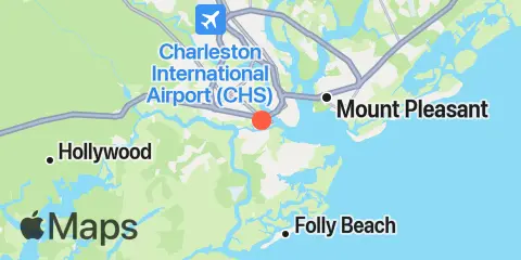
Località e mappa
Nelle vicinanze
Informazioni su queste previsioni
Le altezze di marea sono previsioni, non misurazioni. Vento, pressione atmosferica, tempeste e portata dei fiumi possono causare differenze nei livelli reali dell’acqua. Non utilizzare per la navigazione.
Fonte delle previsioni delle maree:
Tide predictions: NOAA Center for Operational Oceanographic Products and Services (CO-OPS). Fonte ufficiale
Riferimento verticale:
MLLW — Mean Lower Low Water
Dati meteorologici: Open-Meteo
Aggiungi al tuo sito un widget gratuito con le maree o gli orari di pesca per questa stazione.