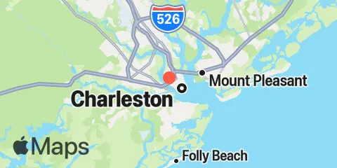
South Ashley Bridge Tavole e grafici settimanali delle maree
Grafico delle maree per i prossimi 7 giorni
About this chart
Legenda del grafico settimanale delle maree di South Ashley Bridge:
Il grafico sopra mostra gli orari e le altezze di alta e bassa marea per South Ashley Bridge nei prossimi sette giorni. La linea rossa indica l'ora attuale e l'altezza stimata.L'escursione di marea a South Ashley Bridge nei prossimi sette giorni è di circa 4.73 ft, con una marea minima di 1.17 ft e massima di 5.9 ft. Puoi anche vedere tutti i dettagli giornalieri su maree e orari di pesca nella scheda Giorno per South Ashley Bridge.
Tavola di marea per i prossimi 7 giorni
▲ Blu = Alta marea
▼ Rosso = Bassa marea
| Giorno | Fase lunare | 1st Marea | 2nd Marea | 3rd Marea | 4th Marea | ☀ Sole |
Orari maggiori

|
Orari minori

|
|---|---|---|---|---|---|---|---|---|
| 15 gio |
 18%
18%
|
▼ 1.17 ft |
▲ 5.9 ft |
▼ 1.52 ft |
▲ 07:24 ▼ 18:47 |
03:41 → 05:41 16:05 → 18:05 |
11:45 → 12:45 21:26 → 22:26 |
|
| 16 ven |
26%
|
▲ 4.99 ft |
▼ 1.4 ft |
▲ 5.69 ft |
▼ 1.74 ft |
▲ 07:25 ▼ 18:45 |
04:31 → 06:31 16:57 → 18:57 |
12:36 → 13:36 22:20 → 23:20 |
| 17 sab |
34%
|
▲ 4.84 ft |
▼ 1.58 ft |
▲ 5.54 ft |
▼ 1.87 ft |
▲ 07:26 ▼ 18:44 |
05:21 → 07:21 17:47 → 19:47 |
13:22 → 14:22 23:16 → 00:16 |
| 18 dom |
 50%
50%
|
▲ 4.77 ft |
▼ 1.68 ft |
▲ 5.48 ft |
▼ 1.88 ft |
▲ 07:26 ▼ 18:43 |
06:09 → 08:09 18:35 → 20:35 |
14:02 → 15:02 |
| 19 lun |
 53%
53%
|
▲ 4.8 ft |
▼ 1.69 ft |
▲ 5.48 ft |
▼ 1.76 ft |
▲ 07:27 ▼ 18:42 |
06:56 → 08:56 19:22 → 21:22 |
00:15 → 01:15 14:37 → 15:37 |
| 20 mar |
63%
|
▲ 4.92 ft |
▼ 1.6 ft |
▲ 5.54 ft |
▼ 1.54 ft |
▲ 07:28 ▼ 18:41 |
07:41 → 09:41 20:08 → 22:08 |
01:14 → 02:14 15:08 → 16:08 |
| 21 mer |
72%
|
▲ 5.16 ft |
▼ 1.42 ft |
▲ 5.64 ft |
▼ 1.24 ft |
▲ 07:29 ▼ 18:40 |
08:24 → 10:24 20:51 → 22:51 |
02:13 → 03:13 15:36 → 16:36 |
Località e mappa
Latitudine
32° 46' 60" N (32.7833)
Longitudine
79° 57' 24" W (-79.9567)
Stato
Contea
Codice postale più vicino
29401
Nelle vicinanze
Maree
1.5 mi
Wappoo Creek, highway bridge, Ashley River
1.9 mi
Charleston, Cooper River Entrance
2.7 mi
James Island Creek, 1 mi. above ent., Ashley River
3.0 mi
Elliott Cut entrance, Stono River
3.3 mi
Duck Island, Ashley River
3.5 mi
Shipyard Creek, 0.8 mile above entrance.
4.0 mi
Cosgrove Bridge, Ashley River
4.0 mi
Fort Johnson
4.2 mi
Hobcaw Point, Wando River
4.4 mi
Shem Creek
5.1 mi
Fort Sumter
5.3 mi
I-526 bridge, Ashley River
5.4 mi
Clouter Creek, south entrance, Cooper River
6.0 mi
The Cove, Fort Moultrie
6.3 mi
Sandblasters, Pennys Creek, Stono River
6.7 mi
Pennys Creek, west entrance, Stono River
6.7 mi
Ben Sawyer Bridge, ICWW
7.1 mi
Drayton, Bee's Ferry, Ashley River
7.3 mi
Sullivans Island (outer coast)
7.5 mi
Folly Creek, Hwy. 171 bridge
7.9 mi
Abbapoola Creek entrance, Stono River
8.2 mi
Folly River, north, Folly Island
8.4 mi
Folly River Bridge, Folly Island
8.4 mi
Breach Inlet, Isle of Palms
8.6 mi
Limehouse Bridge, Stono River
8.6 mi
Clouter Creek, north entrance, Cooper River
8.7 mi
Nowell Creek, Wando River
8.8 mi
Army Depot, Cooper River
9.2 mi
Church Creek bridge, Wadmalaw River
9.3 mi
Folly Island (outer coast)
9.6 mi
Parker Island, Horlbeck Creek, Wando River
9.6 mi
Hamlin Creek, Isle of Palms
9.8 mi
Magnolia Gardens, Ashley River
9.9 mi
Hanahan, Turkey Creek, Goose Creek, Cooper River
10.0 mi
Yeamans Hall, Goose Creek, Cooper River
10.0 mi
Isle of Palms Pier
10.3 mi
Hamlin Sound
10.5 mi
Snake Island, Stono River
10.7 mi
Oak Branch, Bohicket Creek, North Edisto River
11.5 mi
Snow Point, 0.4 mi. North of, Cooper River
12.3 mi
Cainhoy, Wando River
12.4 mi
North Charleston, Ashley River
12.4 mi
Hollywood, Stono River
Correnti
0.2 mi
Ashley River Memorial Bridge, Highway 17
0.8 mi
Wappoo Creek entrance
1.3 mi
Trestle Ruins, marker 6A
1.7 mi
Battery, southwest of
2.0 mi
Lower Town Creek Reach
2.0 mi
Customhouse Reach, off Customhouse
2.1 mi
Town Creek, 0.2 mile above bridge
2.1 mi
Customhouse Reach
2.1 mi
Shutes Folly Island, 0.4 mile west of
2.2 mi
Drum Island, 0.4 mile SSE of
2.4 mi
Horse Reach
2.5 mi
Castle Pinckney, 0.6 mile southwest of
2.5 mi
Hog Island Reach, Buoy 38
2.6 mi
Duck Island, Marker 15
2.7 mi
Bennis Range, Buoy 34
2.8 mi
Elliott Cut, west end
2.8 mi
Drum Island, east of (bridge)
2.9 mi
Castle Pinckney, 0.4 mile south of
3.0 mi
Drum Island, 0.2 mile above
3.0 mi
Drum Island Reach, marker 45
3.0 mi
South Channel, Buoy 4
3.3 mi
Hog Island Reach, SW of Remley Point
3.4 mi
Folly I. Channel, N of Ft. Johnson
3.4 mi
Bennis Range, Buoy 31
3.4 mi
South Chan., 0.4 mi. NW of Ft. Johnson
3.4 mi
Daniel Island Reach, Buoy 48
3.5 mi
Shipyard Creek entrance
3.6 mi
Remley Point, 0.2 mile northwest of
3.7 mi
Johns Island Bridge
3.8 mi
Daniel Island Reach, Buoy 47A
4.0 mi
State Hwy. 7 bridge
4.3 mi
West Marsh Island, 0.1 mile east of
4.5 mi
South Chan., 0.8 mi. ENE of Ft. Johnson
4.7 mi
Hog Island Channel
4.8 mi
Daniel Island Bend
4.9 mi
Wando River Upper Reach, Turning Basin
5.0 mi
Rebellion Reach, 0.8 n.mi. N. of Ft. Sumter
5.0 mi
The Cove, entrance on the Cove Range
5.4 mi
Charleston Harbor (off Fort Sumter)
5.4 mi
Ft. Sumter, 0.6 n.mi. NW of
5.6 mi
North Charleston
6.3 mi
Rathall Creek entrance
7.0 mi
Drayton, Railroad Bridge
7.2 mi
South Jetty, break in
7.2 mi
Fort Sumter Range, Buoy 22
7.2 mi
Filbin Creek Reach, 0.2 mile east of
7.3 mi
Filbin Creek Reach
7.4 mi
Johns Island Airport, south of
7.8 mi
Filbin Creek Reach, Buoy 58
8.0 mi
Charleston Hbr. ent. (between jetties)
8.1 mi
Nowell Creek, Southeast of
8.1 mi
Nowell Creek entrance
8.5 mi
Ordnance Reach
8.7 mi
Johns Island. Main Road Bridge
8.8 mi
Yellow House Creek
9.5 mi
Fort Sumter Range, Buoy 18
9.6 mi
Yellow House Landing, 1 mile NW of
9.6 mi
Horlbeck Creek, 0.2 mile above entrance
10.0 mi
Woods Point, SE of
10.2 mi
North Jetty, 0.8 mile southeast of
10.3 mi
Woods Point
10.5 mi
Pleasant Point
10.6 mi
Snake Island
10.7 mi
Fort Sumter Range, Buoy 16
11.0 mi
Stono Inlet
11.6 mi
Anneville, marker 36
11.7 mi
Snow Point, 0.5 mile north of
12.4 mi
off Amoco Pier
Fonte delle previsioni delle maree:
NOAA
Riferimento verticale:
MLLW — Mean Lower Low Water
Nota: le previsioni delle maree sono stime e NON SONO UTILIZZABILI PER LA NAVIGAZIONE.
Aggiungi al tuo sito un widget gratuito con le maree o gli orari di pesca per questa stazione.