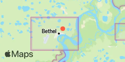
Bethel Gezeiten
Gezeitendiagramm
Über dieses Diagramm
 Hohe Fischaktivität
 Sehr hohe Fischaktivität
Legende zum Gezeitendiagramm für Bethel:
Das Gezeitendiagramm oben zeigt Zeiten und Höhen von Hoch- und Niedrigwasser für Bethel sowie die Solunarperioden (durch Fischsymbole dargestellt). Die rote Linie markiert die aktuelle Zeit und die geschätzte Wasserhöhe.Zwei Fische kennzeichnen solunare Nebenperioden (hohe Fischaktivität); vier Fische kennzeichnen solunare Hauptperioden (sehr hohe Fischaktivität).
Gezeitenzeiten und Wasserstände
| Gezeit | Zeit | Höhe |
|---|---|---|
| Hochwasser | 4.97′ | |
| Niedrigwasser | -0.68′ |
Tidenhub für den : 5.65 ft (Minimum -0.68 ft, Maximum 4.97 ft).
Tidenhub für den : 5.65 ft (Minimum -0.68 ft, Maximum 4.97 ft).
Ortszeiten Höhen in ft bezogen auf MLLW
Wetter- und Seewettervorhersage
Donnerstag, 26. November 2026
- Lufttemperatur
-
19–21 °FNebel / Bedeckt
- Wind
-
0–7 mphBöen bis 16 mph
- Wassertemperatur
-
31–32 °FGeschätzt
| Datum | So, Nov. 22 | Mo, Nov. 23 | Di, Nov. 24 | Mi, Nov. 25 | Do, Nov. 26 | Fr, Nov. 27 | Sa, Nov. 28 | ||||||||||||||||||||||||||||||||||||||||||||||||||||||||||||||||
|---|---|---|---|---|---|---|---|---|---|---|---|---|---|---|---|---|---|---|---|---|---|---|---|---|---|---|---|---|---|---|---|---|---|---|---|---|---|---|---|---|---|---|---|---|---|---|---|---|---|---|---|---|---|---|---|---|---|---|---|---|---|---|---|---|---|---|---|---|---|---|---|
| Vorhersage | |||||||||||||||||||||||||||||||||||||||||||||||||||||||||||||||||||||||
| Wetter °F Niederschlag |
37°
24%
|
37°
22%
|
37°
21%
|
37°
18%
|
37°
14%
|
38°
9%
|
38°
6%
|
37°
6%
|
35°
8%
|
34°
12%
|
33°
19%
|
32°
28%
|
33°
37%
|
35°
45%
|
36°
53%
|
36°
59%
|
35°
63%
|
35°
66%
|
35°
69%
|
34°
71%
|
34°
73%
|
34°
75%
|
34°
79%
|
33°
83%
|
33°
86%
|
33°
85%
|
33°
82%
|
33°
80%
|
33°
79%
|
33°
77%
|
34°
76%
|
35°
74%
|
35°
71%
|
34°
69%
|
34°
68%
|
34°
67%
|
33°
65%
|
33°
62%
|
33°
59%
|
31°
39%
|
30°
33%
|
29°
29%
|
28°
29%
|
24°
16%
|
22°
16%
|
21°
24%
|
23°
10%
|
26°
|
31°
|
28°
|
28°
2%
|
23°
|
20°
|
20°
|
20°
2%
|
20°
|
20°
6%
|
20°
14%
|
19°
22%
|
19°
27%
|
17°
33%
|
18°
37%
|
21°
37%
|
27°
28%
|
28°
20%
|
27°
21%
|
24°
24%
|
23°
25%
|
22°
26%
|
22°
27%
|
25°
29%
|
| Wind mph | 16 Böe 29 | 16 Böe 29 | 15 Böe 29 | 13 Böe 26 | 13 Böe 23 | 12 Böe 23 | 11 Böe 22 | 10 Böe 20 | 8 Böe 18 | 7 Böe 14 | 7 Böe 12 | 6 Böe 12 | 6 Böe 10 | 7 Böe 11 | 8 Böe 14 | 8 Böe 14 | 7 Böe 14 | 7 Böe 13 | 9 Böe 15 | 9 Böe 15 | 8 Böe 15 | 8 Böe 15 | 8 Böe 14 | 8 Böe 14 | 7 Böe 13 | 6 Böe 12 | 5 Böe 10 | 5 Böe 9 | 5 Böe 9 | 6 Böe 9 | 5 Böe 10 | 5 Böe 9 | 5 Böe 9 | 4 Böe 8 | 4 Böe 6 | 5 Böe 9 | 5 Böe 9 | 4 Böe 9 | 4 Böe 7 | 2 Böe 4 | 4 Böe 7 | 6 Böe 10 | 6 Böe 12 | 8 Böe 16 | 8 Böe 15 | 9 Böe 16 | 4 Böe 8 | 3 Böe 7 | 9 Böe 15 | 9 Böe 20 | 9 Böe 19 | 5 Böe 16 | 2 Böe 9 | 1 Böe 7 | 3 Böe 7 | 4 Böe 8 | 4 Böe 8 | 6 Böe 12 | 6 Böe 16 | 6 Böe 11 | 9 Böe 17 | 9 Böe 17 | 10 Böe 19 | 12 Böe 22 | 7 Böe 21 | 8 Böe 18 | 7 Böe 14 | 6 Böe 13 | 6 Böe 12 | 6 Böe 12 | 6 Böe 11 |
| Wasser °F | 31° | 32° | 32° | 32° | 32° | 32° | 32° | 32° | 32° | 32° | 32° | 32° | 32° | 32° | 32° | 32° | 32° | 32° | 32° | 32° | 32° | 32° | 32° | 32° | 32° | 32° | 32° | 32° | 32° | 32° | 32° | 32° | 32° | 32° | 32° | 32° | 32° | 32° | 32° | 32° | 32° | 32° | 32° | 32° | 32° | 32° | 32° | 32° | 32° | 32° | 32° | 32° | 32° | 31° | 31° | 31° | 31° | 31° | 31° | 31° | 31° | 31° | 31° | 31° | 31° | — | — | — | — | — | — |
Sonne, Mond und Angelzeiten
Mondphase
 Abnehmender Dreiviertelmond
92% beleuchtet
Sonne und Mond
- Sonnenaufgang
- Sonnenuntergang
- Monduntergang
- Mondaufgang
Nächste 7 Tage
| Tag | 1st Gezeit | 2nd Gezeit | 3rd Gezeit | 4th Gezeit | ☀ Sonne | Mondphase |
Hauptzeiten
|
Nebenzeiten
|
|---|---|---|---|---|---|---|---|---|
|
4.97 ft
|
-0.68 ft
|
— | — | 10:18 16:49 |
92%
|
02:29 → 04:29 15:02 → 17:02 |
13:44 → 14:44 17:27 → 18:27 |
|
|
5.02 ft
|
— | — | — | 10:20 16:48 |
85%
|
03:34 → 05:34 16:05 → 18:05 |
13:59 → 14:59 19:24 → 20:24 |
|
|
-0.58 ft
|
4.88 ft
|
— | — | 10:23 16:46 |
76%
|
04:35 → 06:35 17:03 → 19:03 |
14:04 → 15:04 21:18 → 22:18 |
|
|
-0.36 ft
|
4.56 ft
|
0.6 ft
|
0.86 ft
|
10:25 16:44 |
65%
|
05:30 → 07:30 17:56 → 19:56 |
14:06 → 15:06 23:04 → 00:04 |
|
|
-0.05 ft
|
4.12 ft
|
0.55 ft
|
1.16 ft
|
10:27 16:43 |
 50% |
06:20 → 08:20 18:44 → 20:44 |
14:06 → 15:06 | |
|
0.28 ft
|
3.62 ft
|
0.46 ft
|
1.58 ft
|
10:29 16:42 |
 43% |
07:07 → 09:07 19:29 → 21:29 |
00:43 → 01:43 14:05 → 15:05 |
|
|
0.55 ft
|
3.12 ft
|
0.34 ft
|
— | 10:31 16:40 |
33%
|
07:51 → 09:51 20:13 → 22:13 |
02:16 → 03:16 14:04 → 15:04 |
Über diese Gezeitenvorhersagen
Gezeitenhöhen sind Vorhersagen, keine Messungen. Wind, Luftdruck, Stürme und Flussabfluss können zu abweichenden tatsächlichen Wasserständen führen. Nicht zur Navigation bestimmt.
Quelle der Gezeitenvorhersagen:
Tide predictions: NOAA Center for Operational Oceanographic Products and Services (CO-OPS). Offizielle Quelle
Höhenbezug:
MLLW — Mean Lower Low Water
Wetterdaten: NOAA & Open-Meteo