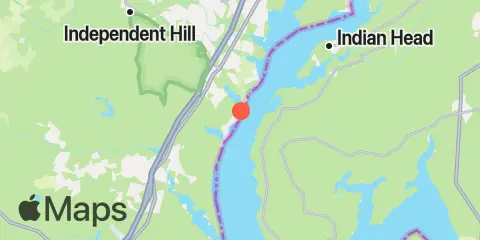
Quantico Tidevand
Tidevandsdiagram
Om denne graf
 Høj fiskeaktivitet
 Meget høj fiskeaktivitet
Forklaring til tidevandsgraf for Quantico:
Tidevandsgrafen ovenfor viser tider og højder for høj- og lavvande ved Quantico samt tidspunkter for solunarperioder (vist med fiskeikoner). Den røde linje markerer det aktuelle tidspunkt og den anslåede vandstand.To fisk markerer små solunarperioder (høj fiskeaktivitet); fire fisk markerer store solunarperioder (meget høj fiskeaktivitet).
Tidevandstider og højder
| Tidevand | Tid | Højde |
|---|---|---|
| Lavvande | -0.18′ | |
| Højvande | 1.32′ | |
| Lavvande | -0.04′ |
Tidevandsforskel for : 1.5 ft (minimum -0.18 ft, maksimum 1.32 ft).
Tidevandsforskel for : 1.5 ft (minimum -0.18 ft, maksimum 1.32 ft).
Lokale tider Højder i ft i forhold til MLLW
Vejr- og havudsigt
lørdag den 13. februar 2027
Ingen prognose tilgængelig for dette valg.
| Dato | søn., nov. 22 | man., nov. 23 | tirs., nov. 24 | ons., nov. 25 | tors., nov. 26 | fre., nov. 27 | lør., nov. 28 | |||||||||||||||||||||||||||||||||||||||||||||||||||||||||
|---|---|---|---|---|---|---|---|---|---|---|---|---|---|---|---|---|---|---|---|---|---|---|---|---|---|---|---|---|---|---|---|---|---|---|---|---|---|---|---|---|---|---|---|---|---|---|---|---|---|---|---|---|---|---|---|---|---|---|---|---|---|---|---|---|
| Prognose | ||||||||||||||||||||||||||||||||||||||||||||||||||||||||||||||||
| Vejr °F Nedbør |
61°
14%
|
61°
16%
|
60°
23%
|
60°
21%
|
60°
22%
|
59°
16%
|
59°
14%
|
58°
16%
|
57°
6%
|
56°
6%
|
54°
5%
|
53°
6%
|
52°
7%
|
51°
8%
|
53°
8%
|
58°
8%
|
62°
8%
|
64°
8%
|
60°
8%
|
59°
8%
|
60°
|
60°
|
58°
|
54°
|
51°
|
48°
|
47°
|
45°
|
43°
|
43°
|
43°
|
41°
|
44°
|
49°
|
50°
|
41°
|
37°
|
34°
|
33°
|
40°
|
46°
|
48°
5%
|
49°
5%
|
48°
31%
|
51°
78%
|
53°
78%
|
56°
81%
|
63°
81%
|
65°
77%
|
63°
77%
|
59°
42%
|
54°
21%
|
48°
21%
|
48°
13%
|
50°
13%
|
49°
4%
|
48°
4%
|
49°
2%
|
48°
3%
|
46°
3%
|
49°
7%
|
54°
7%
|
54°
16%
|
49°
16%
|
| Vind mph | 7 Vindstød 17 | 8 Vindstød 18 | 5 Vindstød 15 | 4 Vindstød 10 | 6 Vindstød 13 | 5 Vindstød 11 | 5 Vindstød 12 | 4 Vindstød 12 | 4 Vindstød 11 | 3 Vindstød 5 | 4 Vindstød 6 | 3 Vindstød 9 | 4 Vindstød 9 | 4 Vindstød 9 | 3 Vindstød 9 | 3 Vindstød 10 | 4 Vindstød 9 | 7 Vindstød 17 | 10 Vindstød 24 | 11 Vindstød 22 | 10 Vindstød 18 | 9 Vindstød 17 | 7 Vindstød 18 | 7 Vindstød 22 | 10 Vindstød 26 | 10 Vindstød 25 | 12 Vindstød 32 | 12 Vindstød 33 | 10 Vindstød 28 | 9 Vindstød 28 | 9 Vindstød 26 | 10 Vindstød 24 | 11 Vindstød 20 | 10 Vindstød 14 | 8 Vindstød 11 | 5 Vindstød 17 | 4 Vindstød 5 | 5 Vindstød 17 | 5 Vindstød 17 | 7 Vindstød 17 | 10 Vindstød 18 | 10 Vindstød 25 | 12 Vindstød 28 | 12 Vindstød 32 | 18 Vindstød 46 | 21 Vindstød 51 | 23 Vindstød 56 | 18 Vindstød 49 | 11 Vindstød 26 | 9 Vindstød 25 | 10 Vindstød 25 | 14 Vindstød 28 | 14 Vindstød 28 | 12 Vindstød 29 | 14 Vindstød 28 | 13 Vindstød 31 | 13 Vindstød 31 | 11 Vindstød 29 | 10 Vindstød 28 | 7 Vindstød 21 | 5 Vindstød 18 | 3 Vindstød 9 | 3 Vindstød 4 | 3 Vindstød 3 |
Sol, måne og fisketider
Månefase
 Tiltagende månesegl
43% belyst
Sol og måne
- Solopgang
- Solnedgang
- Månenedgang
- Måneopgang
Næste 7 dage
| Dag | 1st Tidevand | 2nd Tidevand | 3rd Tidevand | 4th Tidevand | ☀ Sol | Månefase |
Primære tider
|
Sekundære tider
|
|---|---|---|---|---|---|---|---|---|
|
-0.18 ft
|
1.32 ft
|
-0.04 ft
|
— | 07:02 17:44 |
43%
|
04:11 → 06:11 16:38 → 18:38 |
23:37 → 00:37 09:39 → 10:39 |
|
|
1.08 ft
|
-0.14 ft
|
1.31 ft
|
0 ft
|
07:01 17:45 |
 50% |
05:06 → 07:06 17:35 → 19:35 |
00:47 → 01:47 10:20 → 11:20 |
|
|
1.04 ft
|
-0.09 ft
|
1.28 ft
|
0.01 ft
|
07:00 17:46 |
 65% |
06:05 → 08:05 18:37 → 20:37 |
01:58 → 02:58 11:11 → 12:11 |
|
|
1.02 ft
|
-0.06 ft
|
1.26 ft
|
-0.03 ft
|
06:58 17:48 |
76%
|
07:08 → 09:08 19:40 → 21:40 |
03:05 → 04:05 12:13 → 13:13 |
|
|
1.05 ft
|
-0.09 ft
|
1.27 ft
|
-0.1 ft
|
06:57 17:49 |
85%
|
08:12 → 10:12 20:44 → 22:44 |
04:04 → 05:04 13:25 → 14:25 |
|
|
1.13 ft
|
-0.17 ft
|
1.3 ft
|
-0.19 ft
|
06:56 17:50 |
93%
|
09:15 → 11:15 21:44 → 23:44 |
04:53 → 05:53 14:43 → 15:43 |
|
|
1.22 ft
|
-0.27 ft
|
1.33 ft
|
-0.27 ft
|
06:55 17:51 |
98%
|
10:13 → 12:13 22:41 → 00:41 |
05:33 → 06:33 16:02 → 17:02 |
Sted og kort
I nærheden
Om disse tidevandsprognoser
Tidevandshøjder er prognoser, ikke målinger. Vind, lufttryk, storme og vandføring i floder kan få de faktiske vandstande til at afvige. Ikke til navigation.
Kilde til tidevandsprognoser:
Tide predictions: NOAA Center for Operational Oceanographic Products and Services (CO-OPS). Officiel kilde
Vertikalt datum:
MLLW — Mean Lower Low Water
Vejrdata: Open-Meteo
Tilføj en gratis widget med tidevand eller fisketider for denne station til din hjemmeside.